You are here: Home > Network List > TA - USArray Transportable Network (new EarthScope stations) Stations List
> Station L39A Vinton, IA, USA > Earthquake Result Viewer
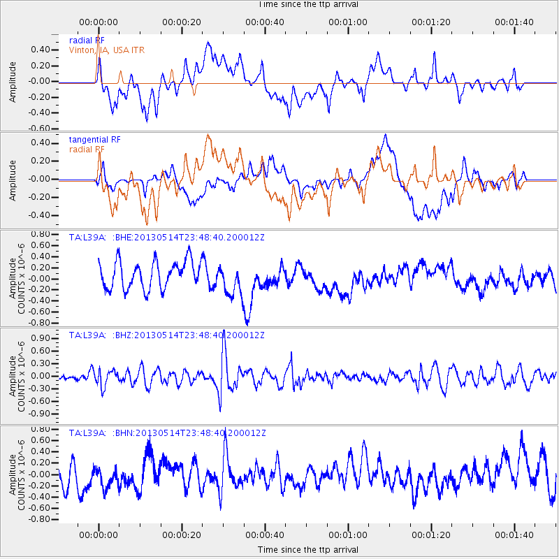
L39A Vinton, IA, USA - Earthquake Result Viewer
*The percent match for this event was below the threshold and hence no stack was calculated.
| Earthquake location: |
Southern Peru |
| Earthquake latitude/longitude: |
-15.7/-73.3 |
| Earthquake time(UTC): |
2013/05/14 (134) 23:39:15 GMT |
| Earthquake Depth: |
105 km |
| Earthquake Magnitude: |
5.5 MW, 5.5 MW, 5.7 MB |
| Earthquake Catalog/Contributor: |
NEIC PDE/NEIC PDE-W |
|
| Network: |
TA USArray Transportable Network (new EarthScope stations) |
| Station: |
L39A Vinton, IA, USA |
| Lat/Lon: |
42.12 N/92.00 W |
| Elevation: |
261 m |
|
| Distance: |
60.0 deg |
| Az: |
344.046 deg |
| Baz: |
159.153 deg |
| Ray Param: |
$rayparam |
*The percent match for this event was below the threshold and hence was not used in the summary stack. |
|
| Radial Match: |
48.599297 % |
| Radial Bump: |
400 |
| Transverse Match: |
37.14985 % |
| Transverse Bump: |
400 |
| SOD ConfigId: |
512894 |
| Insert Time: |
2013-09-14 05:23:23.440 +0000 |
| GWidth: |
2.5 |
| Max Bumps: |
400 |
| Tol: |
0.001 |
|
Signal To Noise
| Channel | StoN | STA | LTA |
| TA:L39A: :BHZ:20130514T23:48:40.200012Z | 1.1961621 | 1.9098901E-7 | 1.5966818E-7 |
| TA:L39A: :BHN:20130514T23:48:40.200012Z | 0.86004454 | 2.5779568E-7 | 2.997469E-7 |
| TA:L39A: :BHE:20130514T23:48:40.200012Z | 1.2194008 | 3.0112795E-7 | 2.4694748E-7 |
| Arrivals |
| Ps | |
| PpPs | |
| PsPs/PpSs | |


