You are here: Home > Network List > TA - USArray Transportable Network (new EarthScope stations) Stations List
> Station S51A Beattyville, KY, USA > Earthquake Result Viewer
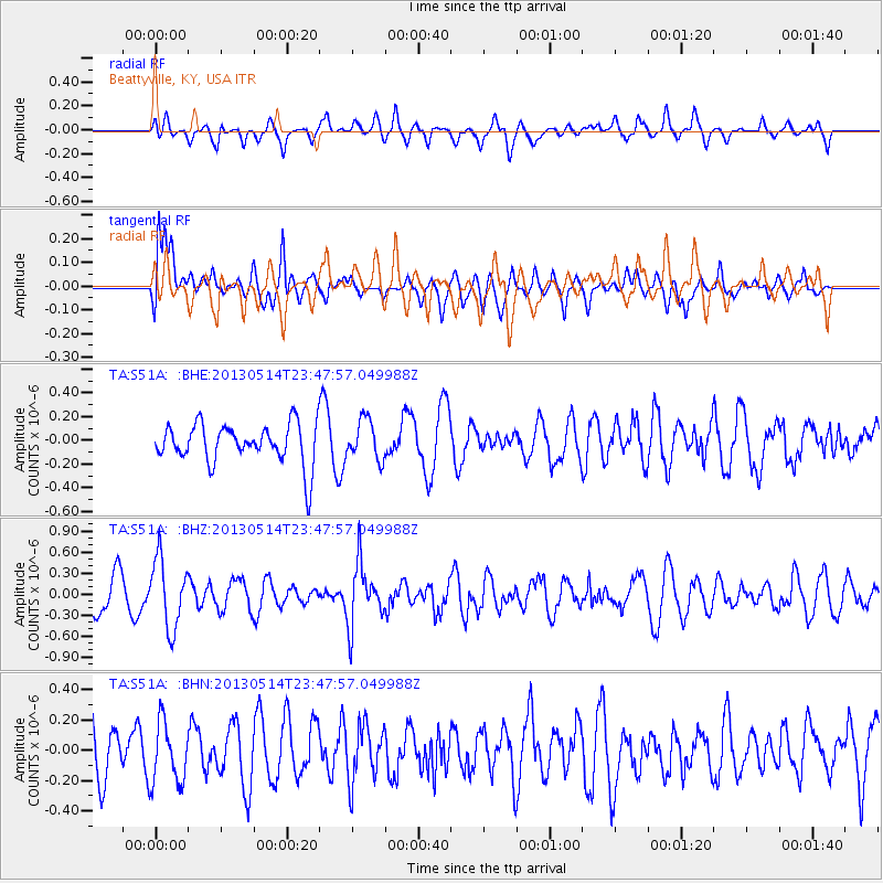
S51A Beattyville, KY, USA - Earthquake Result Viewer
*The percent match for this event was below the threshold and hence no stack was calculated.
| Earthquake location: |
Southern Peru |
| Earthquake latitude/longitude: |
-15.7/-73.3 |
| Earthquake time(UTC): |
2013/05/14 (134) 23:39:15 GMT |
| Earthquake Depth: |
105 km |
| Earthquake Magnitude: |
5.5 MW, 5.5 MW, 5.7 MB |
| Earthquake Catalog/Contributor: |
NEIC PDE/NEIC PDE-W |
|
| Network: |
TA USArray Transportable Network (new EarthScope stations) |
| Station: |
S51A Beattyville, KY, USA |
| Lat/Lon: |
37.64 N/83.59 W |
| Elevation: |
286 m |
|
| Distance: |
53.9 deg |
| Az: |
349.92 deg |
| Baz: |
167.739 deg |
| Ray Param: |
$rayparam |
*The percent match for this event was below the threshold and hence was not used in the summary stack. |
|
| Radial Match: |
52.944683 % |
| Radial Bump: |
400 |
| Transverse Match: |
60.49807 % |
| Transverse Bump: |
400 |
| SOD ConfigId: |
512894 |
| Insert Time: |
2013-09-14 05:29:32.057 +0000 |
| GWidth: |
2.5 |
| Max Bumps: |
400 |
| Tol: |
0.001 |
|
Signal To Noise
| Channel | StoN | STA | LTA |
| TA:S51A: :BHZ:20130514T23:47:57.049988Z | 2.3100173 | 4.904734E-7 | 2.1232455E-7 |
| TA:S51A: :BHN:20130514T23:47:57.049988Z | 0.89530545 | 1.9916507E-7 | 2.2245487E-7 |
| TA:S51A: :BHE:20130514T23:47:57.049988Z | 0.9924214 | 1.6713453E-7 | 1.6841085E-7 |
| Arrivals |
| Ps | |
| PpPs | |
| PsPs/PpSs | |


