You are here: Home > Network List > TA - USArray Transportable Network (new EarthScope stations) Stations List
> Station W52A Murphy, NC, USA > Earthquake Result Viewer
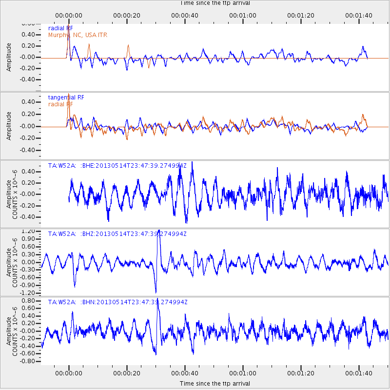
W52A Murphy, NC, USA - Earthquake Result Viewer
*The percent match for this event was below the threshold and hence no stack was calculated.
| Earthquake location: |
Southern Peru |
| Earthquake latitude/longitude: |
-15.7/-73.3 |
| Earthquake time(UTC): |
2013/05/14 (134) 23:39:15 GMT |
| Earthquake Depth: |
105 km |
| Earthquake Magnitude: |
5.5 MW, 5.5 MW, 5.7 MB |
| Earthquake Catalog/Contributor: |
NEIC PDE/NEIC PDE-W |
|
| Network: |
TA USArray Transportable Network (new EarthScope stations) |
| Station: |
W52A Murphy, NC, USA |
| Lat/Lon: |
35.09 N/83.93 W |
| Elevation: |
519 m |
|
| Distance: |
51.5 deg |
| Az: |
348.889 deg |
| Baz: |
166.917 deg |
| Ray Param: |
$rayparam |
*The percent match for this event was below the threshold and hence was not used in the summary stack. |
|
| Radial Match: |
55.20606 % |
| Radial Bump: |
400 |
| Transverse Match: |
47.265858 % |
| Transverse Bump: |
400 |
| SOD ConfigId: |
512894 |
| Insert Time: |
2013-09-14 05:32:35.853 +0000 |
| GWidth: |
2.5 |
| Max Bumps: |
400 |
| Tol: |
0.001 |
|
Signal To Noise
| Channel | StoN | STA | LTA |
| TA:W52A: :BHZ:20130514T23:47:39.274994Z | 2.3551857 | 3.7165682E-7 | 1.5780361E-7 |
| TA:W52A: :BHN:20130514T23:47:39.274994Z | 1.2784125 | 1.9319522E-7 | 1.5112121E-7 |
| TA:W52A: :BHE:20130514T23:47:39.274994Z | 0.92752326 | 1.3227022E-7 | 1.4260583E-7 |
| Arrivals |
| Ps | |
| PpPs | |
| PsPs/PpSs | |


