You are here: Home > Network List > US - United States National Seismic Network Stations List
> Station ERPA Erie, Pennsylvania, USA > Earthquake Result Viewer
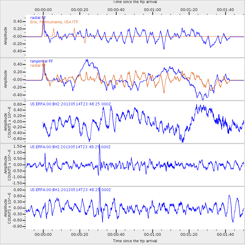
ERPA Erie, Pennsylvania, USA - Earthquake Result Viewer
*The percent match for this event was below the threshold and hence no stack was calculated.
| Earthquake location: |
Southern Peru |
| Earthquake latitude/longitude: |
-15.7/-73.3 |
| Earthquake time(UTC): |
2013/05/14 (134) 23:39:15 GMT |
| Earthquake Depth: |
105 km |
| Earthquake Magnitude: |
5.5 MW, 5.5 MW, 5.7 MB |
| Earthquake Catalog/Contributor: |
NEIC PDE/NEIC PDE-W |
|
| Network: |
US United States National Seismic Network |
| Station: |
ERPA Erie, Pennsylvania, USA |
| Lat/Lon: |
42.12 N/79.99 W |
| Elevation: |
306 m |
|
| Distance: |
57.8 deg |
| Az: |
354.151 deg |
| Baz: |
172.419 deg |
| Ray Param: |
$rayparam |
*The percent match for this event was below the threshold and hence was not used in the summary stack. |
|
| Radial Match: |
66.8759 % |
| Radial Bump: |
400 |
| Transverse Match: |
44.522778 % |
| Transverse Bump: |
400 |
| SOD ConfigId: |
512894 |
| Insert Time: |
2013-09-14 05:36:11.086 +0000 |
| GWidth: |
2.5 |
| Max Bumps: |
400 |
| Tol: |
0.001 |
|
Signal To Noise
| Channel | StoN | STA | LTA |
| US:ERPA:00:BHZ:20130514T23:48:25.000Z | 1.5735118 | 3.1933664E-7 | 2.0294519E-7 |
| US:ERPA:00:BH1:20130514T23:48:25.000Z | 1.5734417 | 2.6647092E-7 | 1.6935543E-7 |
| US:ERPA:00:BH2:20130514T23:48:25.000Z | 1.4698842 | 2.8079893E-7 | 1.9103474E-7 |
| Arrivals |
| Ps | |
| PpPs | |
| PsPs/PpSs | |


