You are here: Home > Network List > UW - Pacific Northwest Regional Seismic Network Stations List
> Station HOOD Mt Hood Meadows, OR CREST BB SMO > Earthquake Result Viewer
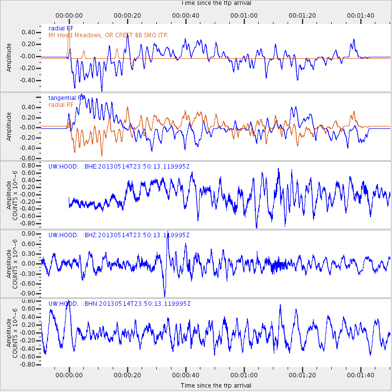
HOOD Mt Hood Meadows, OR CREST BB SMO - Earthquake Result Viewer
*The percent match for this event was below the threshold and hence no stack was calculated.
| Earthquake location: |
Southern Peru |
| Earthquake latitude/longitude: |
-15.7/-73.3 |
| Earthquake time(UTC): |
2013/05/14 (134) 23:39:15 GMT |
| Earthquake Depth: |
105 km |
| Earthquake Magnitude: |
5.5 MW, 5.5 MW, 5.7 MB |
| Earthquake Catalog/Contributor: |
NEIC PDE/NEIC PDE-W |
|
| Network: |
UW Pacific Northwest Regional Seismic Network |
| Station: |
HOOD Mt Hood Meadows, OR CREST BB SMO |
| Lat/Lon: |
45.32 N/121.65 W |
| Elevation: |
1520 m |
|
| Distance: |
74.8 deg |
| Az: |
326.911 deg |
| Baz: |
131.811 deg |
| Ray Param: |
$rayparam |
*The percent match for this event was below the threshold and hence was not used in the summary stack. |
|
| Radial Match: |
64.28088 % |
| Radial Bump: |
400 |
| Transverse Match: |
51.033794 % |
| Transverse Bump: |
400 |
| SOD ConfigId: |
512894 |
| Insert Time: |
2013-09-14 05:39:07.073 +0000 |
| GWidth: |
2.5 |
| Max Bumps: |
400 |
| Tol: |
0.001 |
|
Signal To Noise
| Channel | StoN | STA | LTA |
| UW:HOOD: :BHZ:20130514T23:50:13.119995Z | 1.1197534 | 1.6794208E-7 | 1.499813E-7 |
| UW:HOOD: :BHN:20130514T23:50:13.119995Z | 1.7340218 | 4.3814077E-7 | 2.5267317E-7 |
| UW:HOOD: :BHE:20130514T23:50:13.119995Z | 2.504961 | 4.487629E-7 | 1.7914965E-7 |
| Arrivals |
| Ps | |
| PpPs | |
| PsPs/PpSs | |


