You are here: Home > Network List > CN - Canadian National Seismograph Network Stations List
> Station INK INUVIK, NT > Earthquake Result Viewer
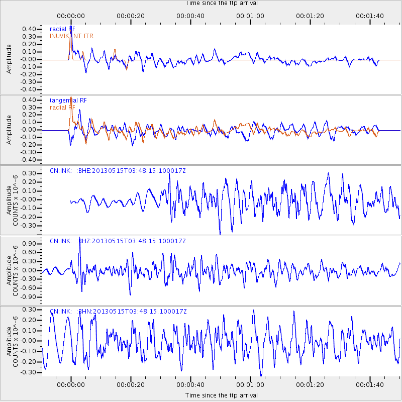
INK INUVIK, NT - Earthquake Result Viewer
*The percent match for this event was below the threshold and hence no stack was calculated.
| Earthquake location: |
New Britain Region, P.N.G. |
| Earthquake latitude/longitude: |
-4.6/152.8 |
| Earthquake time(UTC): |
2013/05/15 (135) 03:36:01 GMT |
| Earthquake Depth: |
59 km |
| Earthquake Magnitude: |
5.7 MW, 5.7 MB, 5.7 MW |
| Earthquake Catalog/Contributor: |
NEIC PDE/NEIC PDE-W |
|
| Network: |
CN Canadian National Seismograph Network |
| Station: |
INK INUVIK, NT |
| Lat/Lon: |
68.31 N/133.53 W |
| Elevation: |
44 m |
|
| Distance: |
88.2 deg |
| Az: |
20.912 deg |
| Baz: |
253.148 deg |
| Ray Param: |
$rayparam |
*The percent match for this event was below the threshold and hence was not used in the summary stack. |
|
| Radial Match: |
66.42614 % |
| Radial Bump: |
400 |
| Transverse Match: |
43.510838 % |
| Transverse Bump: |
400 |
| SOD ConfigId: |
512894 |
| Insert Time: |
2013-09-14 05:50:26.401 +0000 |
| GWidth: |
2.5 |
| Max Bumps: |
400 |
| Tol: |
0.001 |
|
Signal To Noise
| Channel | StoN | STA | LTA |
| CN:INK: :BHZ:20130515T03:48:15.100017Z | 5.1992006 | 3.806945E-7 | 7.3221734E-8 |
| CN:INK: :BHN:20130515T03:48:15.100017Z | 1.0143874 | 1.7485807E-7 | 1.7237801E-7 |
| CN:INK: :BHE:20130515T03:48:15.100017Z | 2.7748098 | 1.2574678E-7 | 4.531726E-8 |
| Arrivals |
| Ps | |
| PpPs | |
| PsPs/PpSs | |


