You are here: Home > Network List > TA - USArray Transportable Network (new EarthScope stations) Stations List
> Station A04D Lummi Island, WA, USA > Earthquake Result Viewer
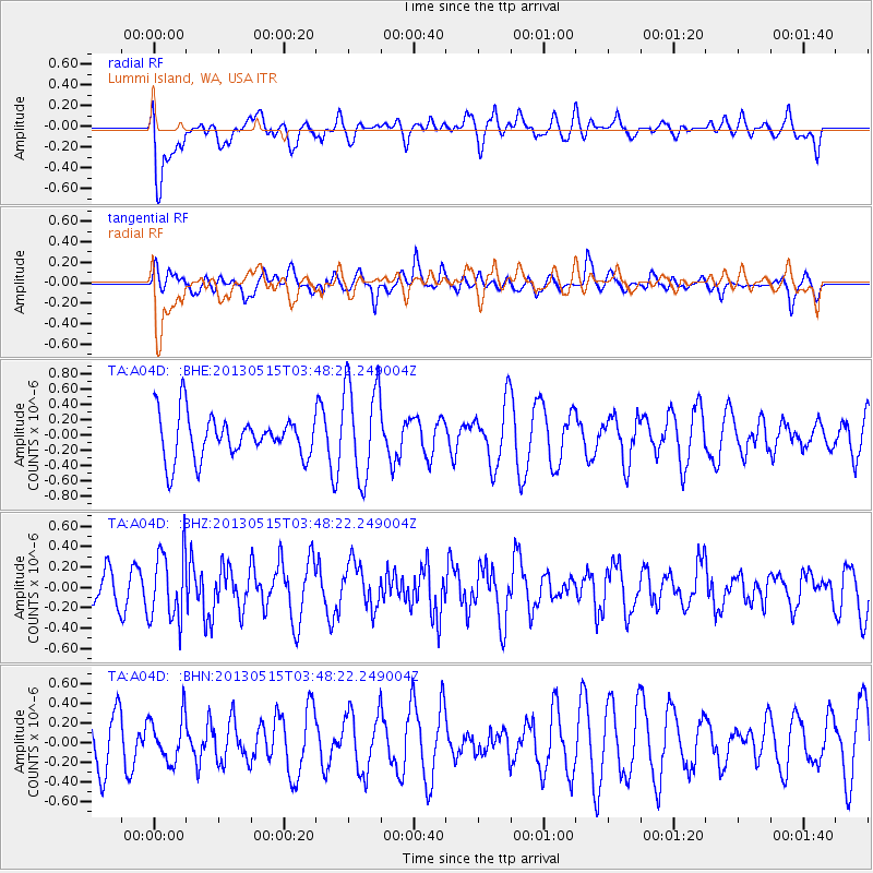
A04D Lummi Island, WA, USA - Earthquake Result Viewer
*The percent match for this event was below the threshold and hence no stack was calculated.
| Earthquake location: |
New Britain Region, P.N.G. |
| Earthquake latitude/longitude: |
-4.6/152.8 |
| Earthquake time(UTC): |
2013/05/15 (135) 03:36:01 GMT |
| Earthquake Depth: |
59 km |
| Earthquake Magnitude: |
5.7 MW, 5.7 MB, 5.7 MW |
| Earthquake Catalog/Contributor: |
NEIC PDE/NEIC PDE-W |
|
| Network: |
TA USArray Transportable Network (new EarthScope stations) |
| Station: |
A04D Lummi Island, WA, USA |
| Lat/Lon: |
48.72 N/122.71 W |
| Elevation: |
13 m |
|
| Distance: |
89.7 deg |
| Az: |
41.236 deg |
| Baz: |
262.865 deg |
| Ray Param: |
$rayparam |
*The percent match for this event was below the threshold and hence was not used in the summary stack. |
|
| Radial Match: |
43.100506 % |
| Radial Bump: |
400 |
| Transverse Match: |
46.94816 % |
| Transverse Bump: |
400 |
| SOD ConfigId: |
512894 |
| Insert Time: |
2013-09-14 05:56:17.456 +0000 |
| GWidth: |
2.5 |
| Max Bumps: |
400 |
| Tol: |
0.001 |
|
Signal To Noise
| Channel | StoN | STA | LTA |
| TA:A04D: :BHZ:20130515T03:48:22.249004Z | 2.085798 | 3.4174116E-7 | 1.6384193E-7 |
| TA:A04D: :BHN:20130515T03:48:22.249004Z | 0.82174027 | 2.2969543E-7 | 2.7952316E-7 |
| TA:A04D: :BHE:20130515T03:48:22.249004Z | 2.2774498 | 6.4299934E-7 | 2.8233305E-7 |
| Arrivals |
| Ps | |
| PpPs | |
| PsPs/PpSs | |


