SYO Syowa Station, Antarctica - Earthquake Result Viewer
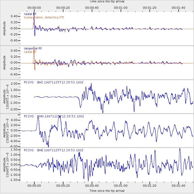
Earthquake location: Minahassa Peninsula, Sulawesi
Earthquake latitude/longitude: 1.2/122.5
Earthquake time(UTC): 1997/11/25 (329) 12:14:33 GMT
Earthquake Depth: 24 km
Earthquake Magnitude: 6.1 MB, 6.8 MS, 7.1 UNKNOWN, 6.7 ME
Earthquake Catalog/Contributor: WHDF/NEIC
Network: PS Pacific21
Station: SYO Syowa Station, Antarctica
Lat/Lon: 69.01 S/39.58 E
Elevation: 20 m
Distance: 88.6 deg
Az: 200.962 deg
Baz: 82.979 deg
Ray Param: 0.042428806
Estimated Moho Depth: 10.0 km
Estimated Crust Vp/Vs: 1.63
Assumed Crust Vp: 6.508 km/s
Estimated Crust Vs: 3.98 km/s
Estimated Crust Poisson's Ratio: 0.20
Radial Match: 90.28496 %
Radial Bump: 400
Transverse Match: 87.07053 %
Transverse Bump: 400
SOD ConfigId: 4480
Insert Time: 2010-02-27 03:35:16.639 +0000
GWidth: 2.5
Max Bumps: 400
Tol: 0.001

Signal To Noise

ChannelStoNSTALTA
PS:SYO: :BHN:19971125T12:26:53.100Z33.8071172.2663396E-66.703735E-8
PS:SYO: :BHE:19971125T12:26:53.100Z1.45520831.2097392E-78.313169E-8
PS:SYO: :BHZ:19971125T12:26:53.100Z16.4592347.4326744E-74.515808E-8
Arrivals
Ps1.0 SECOND
PpPs4.0 SECOND
PsPs/PpSs5.0 SECOND