You are here: Home > Network List > G - GEOSCOPE Stations List
> Station MPG Montagne des Peres, French Guyana > Earthquake Result Viewer
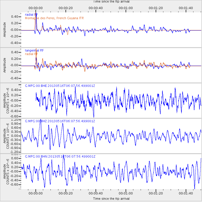
MPG Montagne des Peres, French Guyana - Earthquake Result Viewer
*The percent match for this event was below the threshold and hence no stack was calculated.
| Earthquake location: |
Southern Mid-Atlantic Ridge |
| Earthquake latitude/longitude: |
-57.5/-6.8 |
| Earthquake time(UTC): |
2013/05/16 (136) 05:57:00 GMT |
| Earthquake Depth: |
10 km |
| Earthquake Magnitude: |
5.7 MW, 5.5 MS, 5.6 MW, 5.7 MB |
| Earthquake Catalog/Contributor: |
NEIC PDE/NEIC PDE-W |
|
| Network: |
G GEOSCOPE |
| Station: |
MPG Montagne des Peres, French Guyana |
| Lat/Lon: |
5.11 N/52.64 W |
| Elevation: |
147 m |
|
| Distance: |
72.5 deg |
| Az: |
311.483 deg |
| Baz: |
156.052 deg |
| Ray Param: |
$rayparam |
*The percent match for this event was below the threshold and hence was not used in the summary stack. |
|
| Radial Match: |
62.53366 % |
| Radial Bump: |
400 |
| Transverse Match: |
56.347652 % |
| Transverse Bump: |
400 |
| SOD ConfigId: |
512894 |
| Insert Time: |
2013-09-14 06:02:38.914 +0000 |
| GWidth: |
2.5 |
| Max Bumps: |
400 |
| Tol: |
0.001 |
|
Signal To Noise
| Channel | StoN | STA | LTA |
| G:MPG:00:BHZ:20130516T06:07:56.499001Z | 2.2822251 | 5.8093036E-7 | 2.545456E-7 |
| G:MPG:00:BHN:20130516T06:07:56.499001Z | 1.042978 | 2.3378179E-7 | 2.2414832E-7 |
| G:MPG:00:BHE:20130516T06:07:56.499001Z | 0.8825429 | 1.8701311E-7 | 2.1190256E-7 |
| Arrivals |
| Ps | |
| PpPs | |
| PsPs/PpSs | |


