You are here: Home > Network List > G - GEOSCOPE Stations List
> Station TAM Tamanrasset, Algeria > Earthquake Result Viewer
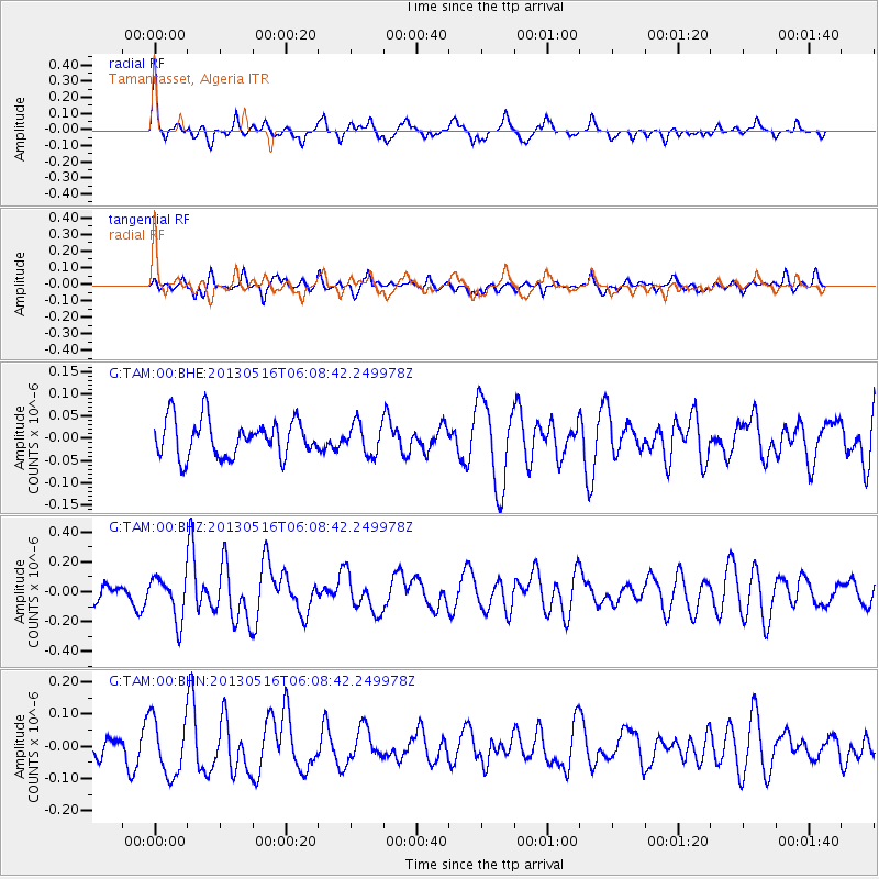
TAM Tamanrasset, Algeria - Earthquake Result Viewer
*The percent match for this event was below the threshold and hence no stack was calculated.
| Earthquake location: |
Southern Mid-Atlantic Ridge |
| Earthquake latitude/longitude: |
-57.5/-6.8 |
| Earthquake time(UTC): |
2013/05/16 (136) 05:57:00 GMT |
| Earthquake Depth: |
10 km |
| Earthquake Magnitude: |
5.7 MW, 5.5 MS, 5.6 MW, 5.7 MB |
| Earthquake Catalog/Contributor: |
NEIC PDE/NEIC PDE-W |
|
| Network: |
G GEOSCOPE |
| Station: |
TAM Tamanrasset, Algeria |
| Lat/Lon: |
22.79 N/5.53 E |
| Elevation: |
1377 m |
|
| Distance: |
80.7 deg |
| Az: |
11.517 deg |
| Baz: |
186.705 deg |
| Ray Param: |
$rayparam |
*The percent match for this event was below the threshold and hence was not used in the summary stack. |
|
| Radial Match: |
71.050446 % |
| Radial Bump: |
359 |
| Transverse Match: |
51.23255 % |
| Transverse Bump: |
400 |
| SOD ConfigId: |
512894 |
| Insert Time: |
2013-09-14 06:02:47.756 +0000 |
| GWidth: |
2.5 |
| Max Bumps: |
400 |
| Tol: |
0.001 |
|
Signal To Noise
| Channel | StoN | STA | LTA |
| G:TAM:00:BHZ:20130516T06:08:42.249978Z | 2.2179239 | 1.4518939E-7 | 6.546184E-8 |
| G:TAM:00:BHN:20130516T06:08:42.249978Z | 2.944103 | 8.7948976E-8 | 2.987293E-8 |
| G:TAM:00:BHE:20130516T06:08:42.249978Z | 0.8318693 | 3.4788677E-8 | 4.181988E-8 |
| Arrivals |
| Ps | |
| PpPs | |
| PsPs/PpSs | |


