SYO Syowa Station, Antarctica - Earthquake Result Viewer
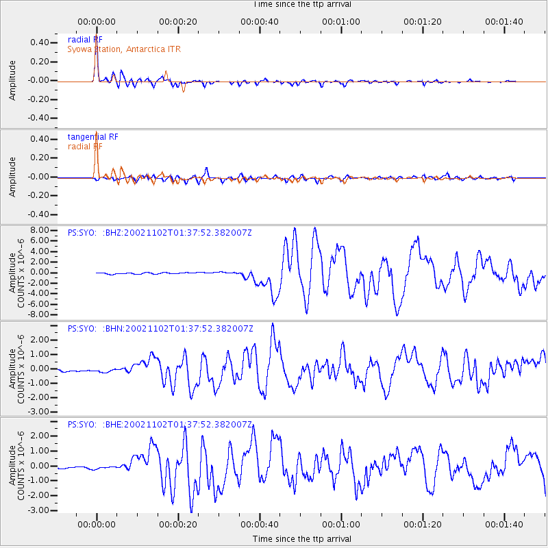
Earthquake location: Northern Sumatra, Indonesia
Earthquake latitude/longitude: 2.8/96.1
Earthquake time(UTC): 2002/11/02 (306) 01:26:10 GMT
Earthquake Depth: 30 km
Earthquake Magnitude: 6.2 MB, 7.6 MS, 7.4 MW, 7.4 MW
Earthquake Catalog/Contributor: WHDF/NEIC
Network: PS Pacific21
Station: SYO Syowa Station, Antarctica
Lat/Lon: 69.01 S/39.58 E
Elevation: 20 m
Distance: 81.2 deg
Az: 197.703 deg
Baz: 57.438 deg
Ray Param: 0.04771566
Estimated Moho Depth: 40.75 km
Estimated Crust Vp/Vs: 1.63
Assumed Crust Vp: 6.508 km/s
Estimated Crust Vs: 3.992 km/s
Estimated Crust Poisson's Ratio: 0.20
Radial Match: 97.76261 %
Radial Bump: 277
Transverse Match: 86.987656 %
Transverse Bump: 400
SOD ConfigId: 4714
Insert Time: 2010-02-27 03:35:44.992 +0000
GWidth: 2.5
Max Bumps: 400
Tol: 0.001

Signal To Noise

ChannelStoNSTALTA
PS:SYO: :BHN:20021102T01:37:52.382007Z1.24753581.0368448E-78.311143E-8
PS:SYO: :BHE:20021102T01:37:52.382007Z1.11501531.3380553E-71.2000332E-7
PS:SYO: :BHZ:20021102T01:37:52.382007Z1.4185161.7889352E-71.2611315E-7
Arrivals
Ps4.1 SECOND
PpPs16 SECOND
PsPs/PpSs20 SECOND