You are here: Home > Network List > TA - USArray Transportable Network (new EarthScope stations) Stations List
> Station 149A Jones, AL, USA > Earthquake Result Viewer
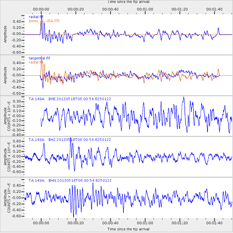
149A Jones, AL, USA - Earthquake Result Viewer
*The percent match for this event was below the threshold and hence no stack was calculated.
| Earthquake location: |
Near East Coast Of Honshu, Japan |
| Earthquake latitude/longitude: |
37.7/141.5 |
| Earthquake time(UTC): |
2013/05/18 (138) 05:47:59 GMT |
| Earthquake Depth: |
39 km |
| Earthquake Magnitude: |
6.0 MW, 5.5 MS, 6.0 MW, 6.1 MB |
| Earthquake Catalog/Contributor: |
NEIC PDE/NEIC PDE-W |
|
| Network: |
TA USArray Transportable Network (new EarthScope stations) |
| Station: |
149A Jones, AL, USA |
| Lat/Lon: |
32.60 N/86.79 W |
| Elevation: |
138 m |
|
| Distance: |
96.8 deg |
| Az: |
39.372 deg |
| Baz: |
323.431 deg |
| Ray Param: |
$rayparam |
*The percent match for this event was below the threshold and hence was not used in the summary stack. |
|
| Radial Match: |
54.895283 % |
| Radial Bump: |
400 |
| Transverse Match: |
70.05287 % |
| Transverse Bump: |
400 |
| SOD ConfigId: |
512894 |
| Insert Time: |
2013-09-14 06:59:00.212 +0000 |
| GWidth: |
2.5 |
| Max Bumps: |
400 |
| Tol: |
0.001 |
|
Signal To Noise
| Channel | StoN | STA | LTA |
| TA:149A: :BHZ:20130518T06:00:54.825012Z | 2.450514 | 2.1296897E-7 | 8.6907875E-8 |
| TA:149A: :BHN:20130518T06:00:54.825012Z | 1.3206586 | 1.2281241E-7 | 9.2993304E-8 |
| TA:149A: :BHE:20130518T06:00:54.825012Z | 1.4028658 | 1.4210474E-7 | 1.0129604E-7 |
| Arrivals |
| Ps | |
| PpPs | |
| PsPs/PpSs | |


