You are here: Home > Network List > TA - USArray Transportable Network (new EarthScope stations) Stations List
> Station D49A Beulah Township, ON, CAN > Earthquake Result Viewer
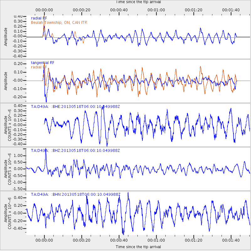
D49A Beulah Township, ON, CAN - Earthquake Result Viewer
*The percent match for this event was below the threshold and hence no stack was calculated.
| Earthquake location: |
Near East Coast Of Honshu, Japan |
| Earthquake latitude/longitude: |
37.7/141.5 |
| Earthquake time(UTC): |
2013/05/18 (138) 05:47:59 GMT |
| Earthquake Depth: |
39 km |
| Earthquake Magnitude: |
6.0 MW, 5.5 MS, 6.0 MW, 6.1 MB |
| Earthquake Catalog/Contributor: |
NEIC PDE/NEIC PDE-W |
|
| Network: |
TA USArray Transportable Network (new EarthScope stations) |
| Station: |
D49A Beulah Township, ON, CAN |
| Lat/Lon: |
47.27 N/81.36 W |
| Elevation: |
416 m |
|
| Distance: |
87.1 deg |
| Az: |
27.613 deg |
| Baz: |
327.342 deg |
| Ray Param: |
$rayparam |
*The percent match for this event was below the threshold and hence was not used in the summary stack. |
|
| Radial Match: |
57.229244 % |
| Radial Bump: |
397 |
| Transverse Match: |
54.665543 % |
| Transverse Bump: |
400 |
| SOD ConfigId: |
512894 |
| Insert Time: |
2013-09-14 06:59:55.619 +0000 |
| GWidth: |
2.5 |
| Max Bumps: |
400 |
| Tol: |
0.001 |
|
Signal To Noise
| Channel | StoN | STA | LTA |
| TA:D49A: :BHZ:20130518T06:00:10.049988Z | 3.7636652 | 4.8530006E-7 | 1.2894347E-7 |
| TA:D49A: :BHN:20130518T06:00:10.049988Z | 0.962487 | 1.3356976E-7 | 1.3877565E-7 |
| TA:D49A: :BHE:20130518T06:00:10.049988Z | 2.0860178 | 2.8234672E-7 | 1.3535201E-7 |
| Arrivals |
| Ps | |
| PpPs | |
| PsPs/PpSs | |


