You are here: Home > Network List > TA - USArray Transportable Network (new EarthScope stations) Stations List
> Station E54A Lac Daplat, Pontiac, MRC, QC, CAN > Earthquake Result Viewer
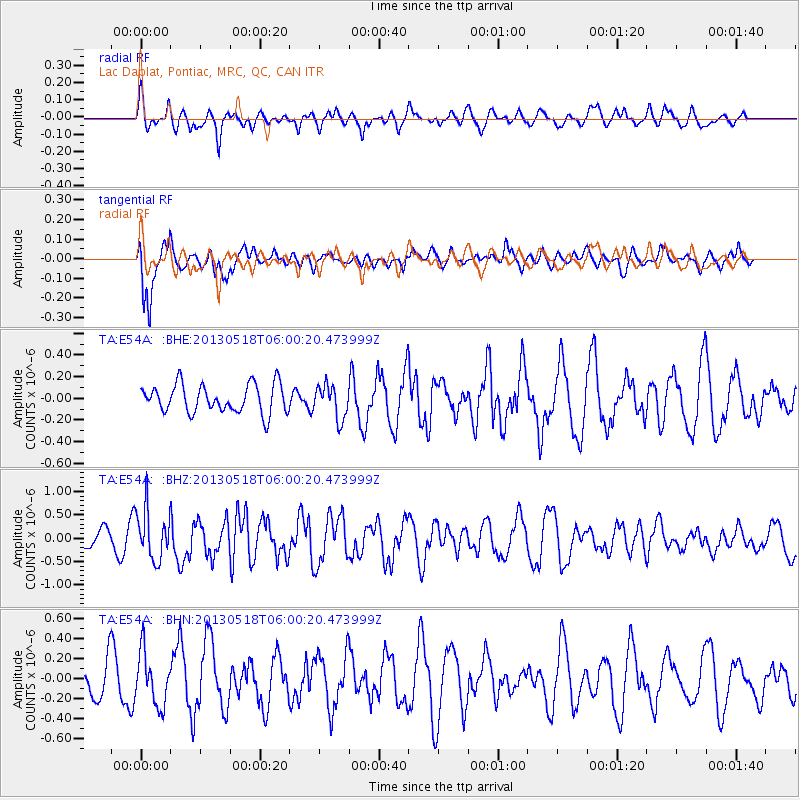
E54A Lac Daplat, Pontiac, MRC, QC, CAN - Earthquake Result Viewer
*The percent match for this event was below the threshold and hence no stack was calculated.
| Earthquake location: |
Near East Coast Of Honshu, Japan |
| Earthquake latitude/longitude: |
37.7/141.5 |
| Earthquake time(UTC): |
2013/05/18 (138) 05:47:59 GMT |
| Earthquake Depth: |
39 km |
| Earthquake Magnitude: |
6.0 MW, 5.5 MS, 6.0 MW, 6.1 MB |
| Earthquake Catalog/Contributor: |
NEIC PDE/NEIC PDE-W |
|
| Network: |
TA USArray Transportable Network (new EarthScope stations) |
| Station: |
E54A Lac Daplat, Pontiac, MRC, QC, CAN |
| Lat/Lon: |
46.43 N/77.19 W |
| Elevation: |
277 m |
|
| Distance: |
89.3 deg |
| Az: |
25.599 deg |
| Baz: |
330.313 deg |
| Ray Param: |
$rayparam |
*The percent match for this event was below the threshold and hence was not used in the summary stack. |
|
| Radial Match: |
43.004078 % |
| Radial Bump: |
400 |
| Transverse Match: |
84.227684 % |
| Transverse Bump: |
364 |
| SOD ConfigId: |
512894 |
| Insert Time: |
2013-09-14 07:00:58.713 +0000 |
| GWidth: |
2.5 |
| Max Bumps: |
400 |
| Tol: |
0.001 |
|
Signal To Noise
| Channel | StoN | STA | LTA |
| TA:E54A: :BHZ:20130518T06:00:20.473999Z | 2.3881736 | 5.3422343E-7 | 2.2369541E-7 |
| TA:E54A: :BHN:20130518T06:00:20.473999Z | 1.099991 | 2.6476246E-7 | 2.4069513E-7 |
| TA:E54A: :BHE:20130518T06:00:20.473999Z | 1.1721379 | 1.5294461E-7 | 1.3048346E-7 |
| Arrivals |
| Ps | |
| PpPs | |
| PsPs/PpSs | |


