You are here: Home > Network List > TA - USArray Transportable Network (new EarthScope stations) Stations List
> Station F49A Sandfield, ON, CAN > Earthquake Result Viewer
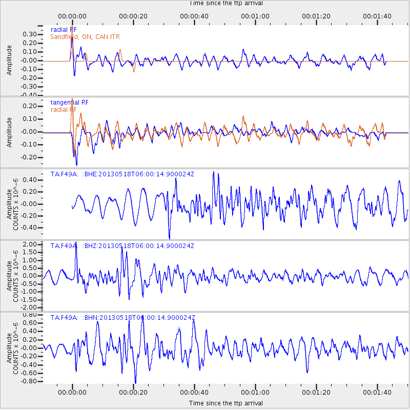
F49A Sandfield, ON, CAN - Earthquake Result Viewer
*The percent match for this event was below the threshold and hence no stack was calculated.
| Earthquake location: |
Near East Coast Of Honshu, Japan |
| Earthquake latitude/longitude: |
37.7/141.5 |
| Earthquake time(UTC): |
2013/05/18 (138) 05:47:59 GMT |
| Earthquake Depth: |
39 km |
| Earthquake Magnitude: |
6.0 MW, 5.5 MS, 6.0 MW, 6.1 MB |
| Earthquake Catalog/Contributor: |
NEIC PDE/NEIC PDE-W |
|
| Network: |
TA USArray Transportable Network (new EarthScope stations) |
| Station: |
F49A Sandfield, ON, CAN |
| Lat/Lon: |
45.76 N/82.04 W |
| Elevation: |
230 m |
|
| Distance: |
88.1 deg |
| Az: |
28.832 deg |
| Baz: |
326.897 deg |
| Ray Param: |
$rayparam |
*The percent match for this event was below the threshold and hence was not used in the summary stack. |
|
| Radial Match: |
57.949505 % |
| Radial Bump: |
400 |
| Transverse Match: |
68.53876 % |
| Transverse Bump: |
356 |
| SOD ConfigId: |
512894 |
| Insert Time: |
2013-09-14 07:01:47.241 +0000 |
| GWidth: |
2.5 |
| Max Bumps: |
400 |
| Tol: |
0.001 |
|
Signal To Noise
| Channel | StoN | STA | LTA |
| TA:F49A: :BHZ:20130518T06:00:14.900024Z | 2.3054297 | 6.78605E-7 | 2.9435074E-7 |
| TA:F49A: :BHN:20130518T06:00:14.900024Z | 1.0754712 | 2.0615569E-7 | 1.9168871E-7 |
| TA:F49A: :BHE:20130518T06:00:14.900024Z | 1.5432779 | 2.3029102E-7 | 1.4922202E-7 |
| Arrivals |
| Ps | |
| PpPs | |
| PsPs/PpSs | |


