You are here: Home > Network List > TA - USArray Transportable Network (new EarthScope stations) Stations List
> Station X48A Hartselle, AL, USA > Earthquake Result Viewer
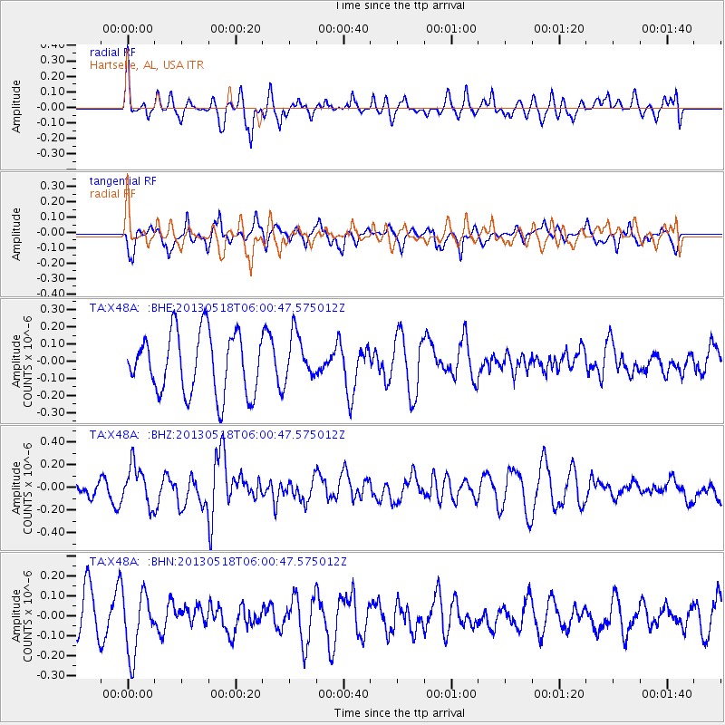
X48A Hartselle, AL, USA - Earthquake Result Viewer
*The percent match for this event was below the threshold and hence no stack was calculated.
| Earthquake location: |
Near East Coast Of Honshu, Japan |
| Earthquake latitude/longitude: |
37.7/141.5 |
| Earthquake time(UTC): |
2013/05/18 (138) 05:47:59 GMT |
| Earthquake Depth: |
39 km |
| Earthquake Magnitude: |
6.0 MW, 5.5 MS, 6.0 MW, 6.1 MB |
| Earthquake Catalog/Contributor: |
NEIC PDE/NEIC PDE-W |
|
| Network: |
TA USArray Transportable Network (new EarthScope stations) |
| Station: |
X48A Hartselle, AL, USA |
| Lat/Lon: |
34.45 N/87.05 W |
| Elevation: |
180 m |
|
| Distance: |
95.2 deg |
| Az: |
38.436 deg |
| Baz: |
323.389 deg |
| Ray Param: |
$rayparam |
*The percent match for this event was below the threshold and hence was not used in the summary stack. |
|
| Radial Match: |
41.228237 % |
| Radial Bump: |
377 |
| Transverse Match: |
46.30889 % |
| Transverse Bump: |
356 |
| SOD ConfigId: |
512894 |
| Insert Time: |
2013-09-14 07:12:53.268 +0000 |
| GWidth: |
2.5 |
| Max Bumps: |
400 |
| Tol: |
0.001 |
|
Signal To Noise
| Channel | StoN | STA | LTA |
| TA:X48A: :BHZ:20130518T06:00:47.575012Z | 2.0141497 | 1.7778963E-7 | 8.827032E-8 |
| TA:X48A: :BHN:20130518T06:00:47.575012Z | 1.8212327 | 1.5623485E-7 | 8.578522E-8 |
| TA:X48A: :BHE:20130518T06:00:47.575012Z | 0.7608486 | 1.3431497E-7 | 1.7653313E-7 |
| Arrivals |
| Ps | |
| PpPs | |
| PsPs/PpSs | |


