NOQ North Oquirrh Mountains, UT, USA - Earthquake Result Viewer
Earthquake location: Near East Coast Of Honshu, Japan
Earthquake latitude/longitude: 37.7/141.5
Earthquake time(UTC): 2013/05/18 (138) 05:47:59 GMT
Earthquake Depth: 39 km
Earthquake Magnitude: 6.0 MW, 5.5 MS, 6.0 MW, 6.1 MB
Earthquake Catalog/Contributor: NEIC PDE/NEIC PDE-W
Network: UU University of Utah Regional Network
Station: NOQ North Oquirrh Mountains, UT, USA
Lat/Lon: 40.65 N/112.12 W
Elevation: 1622 m
Distance: 77.0 deg
Az: 48.51 deg
Baz: 308.69 deg
Ray Param: 0.05056354
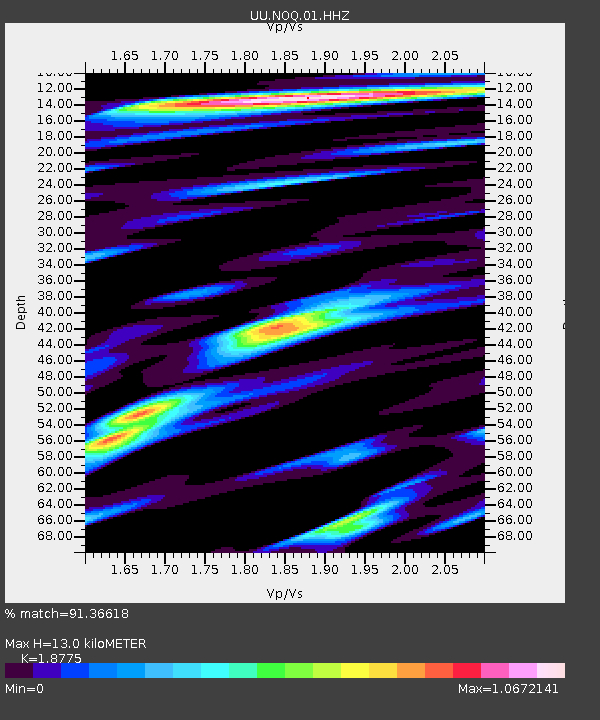
Estimated Moho Depth: 13.0 km
Estimated Crust Vp/Vs: 1.88
Assumed Crust Vp: 6.276 km/s
Estimated Crust Vs: 3.343 km/s
Estimated Crust Poisson's Ratio: 0.30
Radial Match: 91.36618 %
Radial Bump: 400
Transverse Match: 80.95155 %
Transverse Bump: 400
SOD ConfigId: 512894
Insert Time: 2013-09-14 07:17:09.459 +0000
GWidth: 2.5
Max Bumps: 400
Tol: 0.001

Signal To Noise

ChannelStoNSTALTA
UU:NOQ:01:HHZ:20130518T05:59:17.179016Z5.00965171.3883917E-82.7714337E-9
UU:NOQ:01:HHN:20130518T05:59:17.179016Z3.30149846.2661103E-91.8979593E-9
UU:NOQ:01:HHE:20130518T05:59:17.179016Z2.12690545.2663536E-92.4760636E-9
Arrivals
Ps1.9 SECOND
PpPs5.8 SECOND
PsPs/PpSs7.7 SECOND