MRBL Marblemount, WA, USA - Earthquake Result Viewer
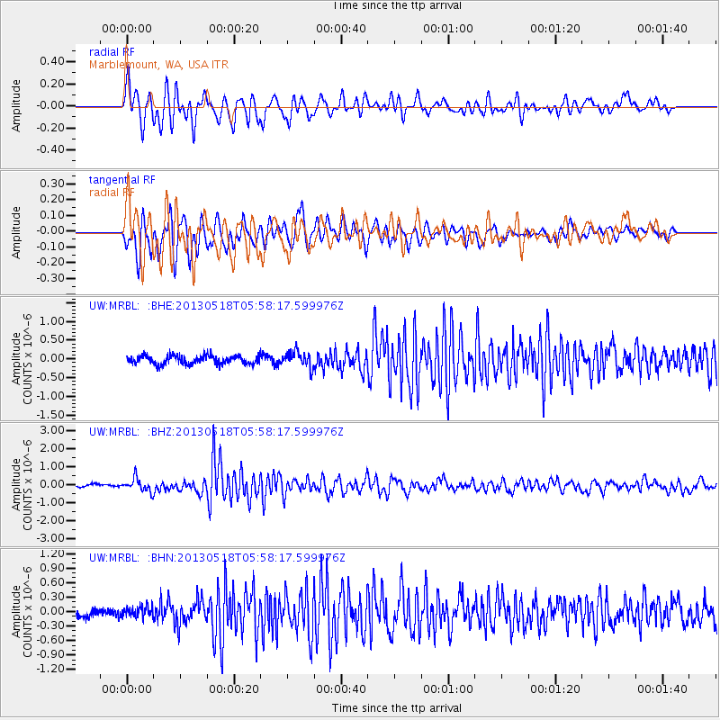
Earthquake location: Near East Coast Of Honshu, Japan
Earthquake latitude/longitude: 37.7/141.5
Earthquake time(UTC): 2013/05/18 (138) 05:47:59 GMT
Earthquake Depth: 39 km
Earthquake Magnitude: 6.0 MW, 5.5 MS, 6.0 MW, 6.1 MB
Earthquake Catalog/Contributor: NEIC PDE/NEIC PDE-W
Network: UW Pacific Northwest Regional Seismic Network
Station: MRBL Marblemount, WA, USA
Lat/Lon: 48.52 N/121.48 W
Elevation: 75 m
Distance: 67.0 deg
Az: 45.791 deg
Baz: 301.272 deg
Ray Param: 0.057168856
Estimated Moho Depth: 39.75 km
Estimated Crust Vp/Vs: 1.69
Assumed Crust Vp: 6.566 km/s
Estimated Crust Vs: 3.88 km/s
Estimated Crust Poisson's Ratio: 0.23
Radial Match: 82.25575 %
Radial Bump: 400
Transverse Match: 82.92904 %
Transverse Bump: 400
SOD ConfigId: 512894
Insert Time: 2013-09-14 07:18:38.368 +0000
GWidth: 2.5
Max Bumps: 400
Tol: 0.001

Signal To Noise

ChannelStoNSTALTA
UW:MRBL: :BHZ:20130518T05:58:17.599976Z4.4714573.723092E-78.326351E-8
UW:MRBL: :BHN:20130518T05:58:17.599976Z1.09598461.0789979E-79.845009E-8
UW:MRBL: :BHE:20130518T05:58:17.599976Z1.88262342.098621E-71.1147323E-7
Arrivals
Ps4.4 SECOND
PpPs16 SECOND
PsPs/PpSs20 SECOND