You are here: Home > Network List > TA - USArray Transportable Network (new EarthScope stations) Stations List
> Station Y59A Loris, SC, USA > Earthquake Result Viewer
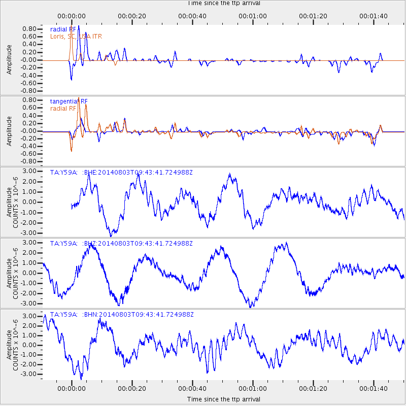
Y59A Loris, SC, USA - Earthquake Result Viewer
*The percent match for this event was below the threshold and hence no stack was calculated.
| Earthquake location: |
Near West Coast Of Colombia |
| Earthquake latitude/longitude: |
3.6/-77.7 |
| Earthquake time(UTC): |
2014/08/03 (215) 09:38:06 GMT |
| Earthquake Depth: |
62 km |
| Earthquake Magnitude: |
5.2 mb, 5.0 Mwr |
| Earthquake Catalog/Contributor: |
ISC/ISC |
|
| Network: |
TA USArray Transportable Network (new EarthScope stations) |
| Station: |
Y59A Loris, SC, USA |
| Lat/Lon: |
33.99 N/78.87 W |
| Elevation: |
2.0 m |
|
| Distance: |
30.3 deg |
| Az: |
358.055 deg |
| Baz: |
177.664 deg |
| Ray Param: |
$rayparam |
*The percent match for this event was below the threshold and hence was not used in the summary stack. |
|
| Radial Match: |
78.42656 % |
| Radial Bump: |
400 |
| Transverse Match: |
55.583374 % |
| Transverse Bump: |
400 |
| SOD ConfigId: |
3390531 |
| Insert Time: |
2019-04-13 04:44:04.009 +0000 |
| GWidth: |
2.5 |
| Max Bumps: |
400 |
| Tol: |
0.001 |
|
Signal To Noise
| Channel | StoN | STA | LTA |
| TA:Y59A: :BHZ:20140803T09:43:41.724988Z | 1.0384004 | 1.1749578E-6 | 1.1315075E-6 |
| TA:Y59A: :BHN:20140803T09:43:41.724988Z | 1.3239517 | 2.4694814E-6 | 1.8652352E-6 |
| TA:Y59A: :BHE:20140803T09:43:41.724988Z | 0.5780628 | 9.787251E-7 | 1.693112E-6 |
| Arrivals |
| Ps | |
| PpPs | |
| PsPs/PpSs | |


