You are here: Home > Network List > US - United States National Seismic Network Stations List
> Station HAWA Hanford, Washington, USA > Earthquake Result Viewer
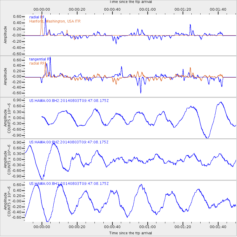
HAWA Hanford, Washington, USA - Earthquake Result Viewer
*The percent match for this event was below the threshold and hence no stack was calculated.
| Earthquake location: |
Near West Coast Of Colombia |
| Earthquake latitude/longitude: |
3.6/-77.7 |
| Earthquake time(UTC): |
2014/08/03 (215) 09:38:06 GMT |
| Earthquake Depth: |
62 km |
| Earthquake Magnitude: |
5.2 mb, 5.0 Mwr |
| Earthquake Catalog/Contributor: |
ISC/ISC |
|
| Network: |
US United States National Seismic Network |
| Station: |
HAWA Hanford, Washington, USA |
| Lat/Lon: |
46.39 N/119.53 W |
| Elevation: |
364 m |
|
| Distance: |
56.0 deg |
| Az: |
326.15 deg |
| Baz: |
126.56 deg |
| Ray Param: |
$rayparam |
*The percent match for this event was below the threshold and hence was not used in the summary stack. |
|
| Radial Match: |
83.20999 % |
| Radial Bump: |
400 |
| Transverse Match: |
83.32695 % |
| Transverse Bump: |
400 |
| SOD ConfigId: |
3390531 |
| Insert Time: |
2019-04-13 04:44:22.129 +0000 |
| GWidth: |
2.5 |
| Max Bumps: |
400 |
| Tol: |
0.001 |
|
Signal To Noise
| Channel | StoN | STA | LTA |
| US:HAWA:00:BHZ:20140803T09:47:08.175Z | 1.7599825 | 7.1401115E-7 | 4.0569222E-7 |
| US:HAWA:00:BH1:20140803T09:47:08.175Z | 1.3652226 | 4.874639E-7 | 3.5705824E-7 |
| US:HAWA:00:BH2:20140803T09:47:08.175Z | 1.3453861 | 3.635825E-7 | 2.70244E-7 |
| Arrivals |
| Ps | |
| PpPs | |
| PsPs/PpSs | |


