You are here: Home > Network List > IU - Global Seismograph Network (GSN - IRIS/USGS) Stations List
> Station CCM Cathedral Cave, Missouri, USA > Earthquake Result Viewer
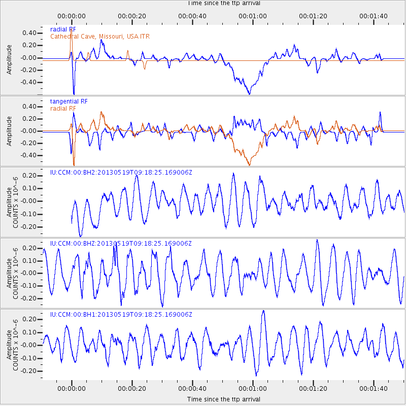
CCM Cathedral Cave, Missouri, USA - Earthquake Result Viewer
*The percent match for this event was below the threshold and hence no stack was calculated.
| Earthquake location: |
Northern Algeria |
| Earthquake latitude/longitude: |
36.7/5.3 |
| Earthquake time(UTC): |
2013/05/19 (139) 09:07:26 GMT |
| Earthquake Depth: |
6.7 km |
| Earthquake Magnitude: |
5.5 ML |
| Earthquake Catalog/Contributor: |
NEIC PDE/NEIC PDE-W |
|
| Network: |
IU Global Seismograph Network (GSN - IRIS/USGS) |
| Station: |
CCM Cathedral Cave, Missouri, USA |
| Lat/Lon: |
38.06 N/91.24 W |
| Elevation: |
222 m |
|
| Distance: |
72.9 deg |
| Az: |
304.871 deg |
| Baz: |
56.642 deg |
| Ray Param: |
$rayparam |
*The percent match for this event was below the threshold and hence was not used in the summary stack. |
|
| Radial Match: |
52.764915 % |
| Radial Bump: |
400 |
| Transverse Match: |
55.510143 % |
| Transverse Bump: |
400 |
| SOD ConfigId: |
512894 |
| Insert Time: |
2013-09-14 07:58:20.461 +0000 |
| GWidth: |
2.5 |
| Max Bumps: |
400 |
| Tol: |
0.001 |
|
Signal To Noise
| Channel | StoN | STA | LTA |
| IU:CCM:00:BHZ:20130519T09:18:25.169006Z | 0.7981748 | 9.947968E-8 | 1.2463396E-7 |
| IU:CCM:00:BH1:20130519T09:18:25.169006Z | 0.63796544 | 1.0783788E-7 | 1.6903405E-7 |
| IU:CCM:00:BH2:20130519T09:18:25.169006Z | 0.62805784 | 6.965021E-8 | 1.10897766E-7 |
| Arrivals |
| Ps | |
| PpPs | |
| PsPs/PpSs | |


