KAN13 Rinehart Farm - Earthquake Result Viewer

*The percent match for this event was below the threshold and hence no stack was calculated.
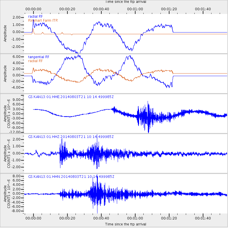
Earthquake location: Peru-Ecuador Border Region
Earthquake latitude/longitude: -3.9/-80.8
Earthquake time(UTC): 2014/08/03 (215) 21:02:46 GMT
Earthquake Depth: 58 km
Earthquake Magnitude: 5.5 MW, 4.4 mb, 4.5 mb1, 4.5 mb1mx, 4.7 mbtmp, 5.0 MS, 5.0 Ms1, 4.9 ms1mx
Earthquake Catalog/Contributor: ISC/ISC
Network: GS US Geological Survey Networks
Station: KAN13 Rinehart Farm
Lat/Lon: 37.01 N/97.48 W
Elevation: 340 m

*The percent match for this event was below the threshold and hence was not used in the summary stack.

Distance: 43.6 deg
Az: 340.512 deg
Baz: 155.428 deg
Ray Param: $rayparam
Radial Match: 41.339146 %
Radial Bump: 400
Transverse Match: 47.432774 %
Transverse Bump: 400
SOD ConfigId: 3390531
Insert Time: 2019-04-13 04:49:28.555 +0000
GWidth: 2.5
Max Bumps: 400
Tol: 0.001

Signal To Noise

ChannelStoNSTALTA
GS:KAN13:01:HHZ:20140803T21:10:14.499985Z2.9247332.1514103E-77.355921E-8
GS:KAN13:01:HHN:20140803T21:10:14.499985Z0.84225251.6911812E-72.0079266E-7
GS:KAN13:01:HHE:20140803T21:10:14.499985Z0.196038383.5928372E-71.8327213E-6
Arrivals
Ps
PpPs
PsPs/PpSs