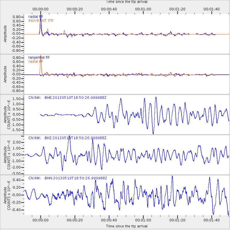
INK INUVIK, NT - Earthquake Result Viewer
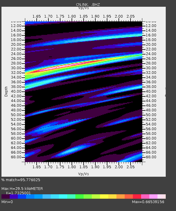
Earthquake location: Off East Coast Of Kamchatka
Earthquake latitude/longitude: 52.3/160.1
Earthquake time(UTC): 2013/05/19 (139) 18:44:10 GMT
Earthquake Depth: 18 km
Earthquake Magnitude: 6.1 MW, 5.8 MS, 5.9 MB, 5.9 MW
Earthquake Catalog/Contributor: NEIC PDE/NEIC PDE-W
Network: CN Canadian National Seismograph Network
Station: INK INUVIK, NT
Lat/Lon: 68.31 N/133.53 W
Elevation: 44 m
Distance: 34.5 deg
Az: 37.005 deg
Baz: 276.66 deg
Ray Param: 0.07770209
Estimated Moho Depth: 29.5 km
Estimated Crust Vp/Vs: 1.73
Assumed Crust Vp: 6.171 km/s
Estimated Crust Vs: 3.562 km/s
Estimated Crust Poisson's Ratio: 0.25
Radial Match: 95.776825 %
Radial Bump: 248
Transverse Match: 59.037624 %
Transverse Bump: 400
SOD ConfigId: 512894
Insert Time: 2013-09-14 08:34:23.825 +0000
GWidth: 2.5
Max Bumps: 400
Tol: 0.001

Signal To Noise

ChannelStoNSTALTA
CN:INK: :BHZ:20130519T18:50:26.999988Z8.6372637.981711E-79.241018E-8
CN:INK: :BHN:20130519T18:50:26.999988Z0.64627125.310406E-88.2169926E-8
CN:INK: :BHE:20130519T18:50:26.999988Z9.9604344.6044184E-74.6227083E-8
Arrivals
Ps3.8 SECOND
PpPs12 SECOND
PsPs/PpSs16 SECOND