GNI Garni, Armenia - Earthquake Result Viewer
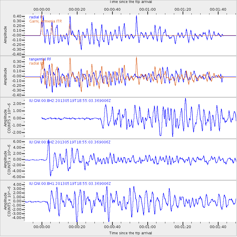
Earthquake location: Off East Coast Of Kamchatka
Earthquake latitude/longitude: 52.3/160.1
Earthquake time(UTC): 2013/05/19 (139) 18:44:10 GMT
Earthquake Depth: 18 km
Earthquake Magnitude: 6.1 MW, 5.8 MS, 5.9 MB, 5.9 MW
Earthquake Catalog/Contributor: NEIC PDE/NEIC PDE-W
Network: IU Global Seismograph Network (GSN - IRIS/USGS)
Station: GNI Garni, Armenia
Lat/Lon: 40.15 N/44.74 E
Elevation: 1609 m
Distance: 72.2 deg
Az: 313.301 deg
Baz: 35.628 deg
Ray Param: 0.053814713
Estimated Moho Depth: 34.5 km
Estimated Crust Vp/Vs: 2.07
Assumed Crust Vp: 6.291 km/s
Estimated Crust Vs: 3.035 km/s
Estimated Crust Poisson's Ratio: 0.35
Radial Match: 86.07805 %
Radial Bump: 400
Transverse Match: 84.29956 %
Transverse Bump: 400
SOD ConfigId: 512894
Insert Time: 2013-09-14 08:42:38.814 +0000
GWidth: 2.5
Max Bumps: 400
Tol: 0.001

Signal To Noise

ChannelStoNSTALTA
IU:GNI:00:BHZ:20130519T18:55:03.369006Z35.1086462.5004415E-67.12201E-8
IU:GNI:00:BH1:20130519T18:55:03.369006Z10.6852338.300434E-77.768136E-8
IU:GNI:00:BH2:20130519T18:55:03.369006Z7.56567054.416179E-75.8371285E-8
Arrivals
Ps6.1 SECOND
PpPs16 SECOND
PsPs/PpSs22 SECOND