You are here: Home > Network List > TA - USArray Transportable Network (new EarthScope stations) Stations List
> Station T49A Edmonton, KY, USA > Earthquake Result Viewer
T49A Edmonton, KY, USA - Earthquake Result Viewer

| Earthquake location: |
Off East Coast Of Kamchatka |
| Earthquake latitude/longitude: |
52.3/160.1 |
| Earthquake time(UTC): |
2013/05/19 (139) 18:44:10 GMT |
| Earthquake Depth: |
18 km |
| Earthquake Magnitude: |
6.1 MW, 5.8 MS, 5.9 MB, 5.9 MW |
| Earthquake Catalog/Contributor: |
NEIC PDE/NEIC PDE-W |
|
| Network: |
TA USArray Transportable Network (new EarthScope stations) |
| Station: |
T49A Edmonton, KY, USA |
| Lat/Lon: |
37.10 N/85.53 W |
| Elevation: |
313 m |
|
| Distance: |
74.2 deg |
| Az: |
49.158 deg |
| Baz: |
324.509 deg |
| Ray Param: |
0.052454844 |
| Estimated Moho Depth: |
65.5 km |
| Estimated Crust Vp/Vs: |
1.96 |
| Assumed Crust Vp: |
6.476 km/s |
| Estimated Crust Vs: |
3.312 km/s |
| Estimated Crust Poisson's Ratio: |
0.32 |
|
| Radial Match: |
86.31023 % |
| Radial Bump: |
400 |
| Transverse Match: |
78.59244 % |
| Transverse Bump: |
400 |
| SOD ConfigId: |
512894 |
| Insert Time: |
2013-09-14 09:14:05.780 +0000 |
| GWidth: |
2.5 |
| Max Bumps: |
400 |
| Tol: |
0.001 |
|
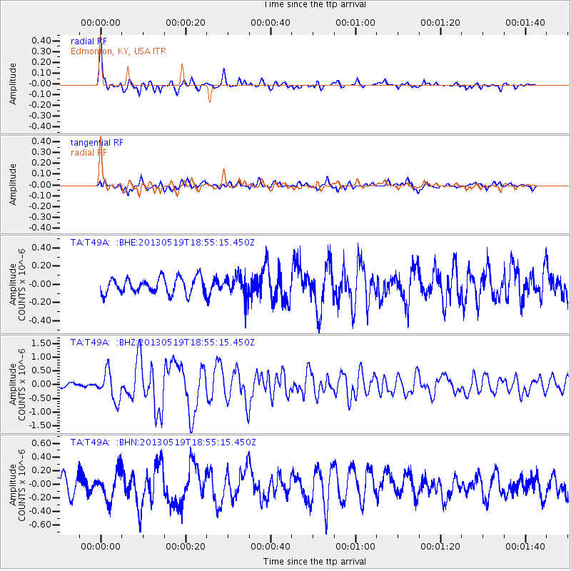
Signal To Noise
| Channel | StoN | STA | LTA |
| TA:T49A: :BHZ:20130519T18:55:15.450Z | 6.5838227 | 5.324735E-7 | 8.087604E-8 |
| TA:T49A: :BHN:20130519T18:55:15.450Z | 1.8152387 | 2.1085086E-7 | 1.16155995E-7 |
| TA:T49A: :BHE:20130519T18:55:15.450Z | 1.3877847 | 1.2031933E-7 | 8.669884E-8 |
| Arrivals |
| Ps | 10.0 SECOND |
| PpPs | 29 SECOND |
| PsPs/PpSs | 39 SECOND |


