You are here: Home > Network List > GS - US Geological Survey Networks Stations List
> Station KAN10 Keim Farm > Earthquake Result Viewer
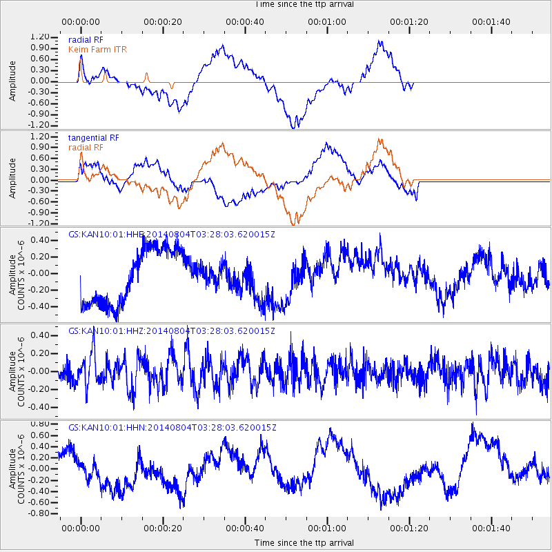
KAN10 Keim Farm - Earthquake Result Viewer
*The percent match for this event was below the threshold and hence no stack was calculated.
| Earthquake location: |
Near Coast Of Northern Peru |
| Earthquake latitude/longitude: |
-6.9/-81.6 |
| Earthquake time(UTC): |
2014/08/04 (216) 03:20:09 GMT |
| Earthquake Depth: |
23 km |
| Earthquake Magnitude: |
5.3 MW, 5.4 mb, 5.3 Mwb |
| Earthquake Catalog/Contributor: |
ISC/ISC |
|
| Network: |
GS US Geological Survey Networks |
| Station: |
KAN10 Keim Farm |
| Lat/Lon: |
37.12 N/98.10 W |
| Elevation: |
417 m |
|
| Distance: |
46.4 deg |
| Az: |
341.76 deg |
| Baz: |
157.121 deg |
| Ray Param: |
$rayparam |
*The percent match for this event was below the threshold and hence was not used in the summary stack. |
|
| Radial Match: |
43.582966 % |
| Radial Bump: |
400 |
| Transverse Match: |
38.582157 % |
| Transverse Bump: |
400 |
| SOD ConfigId: |
3390531 |
| Insert Time: |
2019-04-13 05:01:22.192 +0000 |
| GWidth: |
2.5 |
| Max Bumps: |
400 |
| Tol: |
0.001 |
|
Signal To Noise
| Channel | StoN | STA | LTA |
| GS:KAN10:01:HHZ:20140804T03:28:03.620015Z | 1.8837506 | 1.8291036E-7 | 9.709903E-8 |
| GS:KAN10:01:HHN:20140804T03:28:03.620015Z | 0.55075455 | 2.037215E-7 | 3.6989528E-7 |
| GS:KAN10:01:HHE:20140804T03:28:03.620015Z | 0.30855292 | 1.0130103E-7 | 3.2831008E-7 |
| Arrivals |
| Ps | |
| PpPs | |
| PsPs/PpSs | |


