You are here: Home > Network List > TA - USArray Transportable Network (new EarthScope stations) Stations List
> Station R41A Rosebud, MO, USA > Earthquake Result Viewer
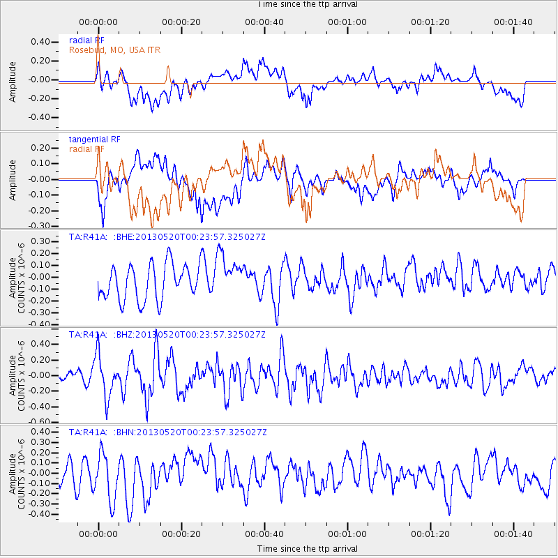
R41A Rosebud, MO, USA - Earthquake Result Viewer
*The percent match for this event was below the threshold and hence no stack was calculated.
| Earthquake location: |
Off East Coast Of Kamchatka |
| Earthquake latitude/longitude: |
52.3/160.3 |
| Earthquake time(UTC): |
2013/05/20 (140) 00:13:17 GMT |
| Earthquake Depth: |
35 km |
| Earthquake Magnitude: |
5.5 MW, 5.5 MB |
| Earthquake Catalog/Contributor: |
NEIC PDE/NEIC PDE-W |
|
| Network: |
TA USArray Transportable Network (new EarthScope stations) |
| Station: |
R41A Rosebud, MO, USA |
| Lat/Lon: |
38.30 N/91.38 W |
| Elevation: |
257 m |
|
| Distance: |
70.5 deg |
| Az: |
52.415 deg |
| Baz: |
321.747 deg |
| Ray Param: |
$rayparam |
*The percent match for this event was below the threshold and hence was not used in the summary stack. |
|
| Radial Match: |
33.21531 % |
| Radial Bump: |
400 |
| Transverse Match: |
63.174995 % |
| Transverse Bump: |
400 |
| SOD ConfigId: |
512894 |
| Insert Time: |
2013-09-14 09:58:50.395 +0000 |
| GWidth: |
2.5 |
| Max Bumps: |
400 |
| Tol: |
0.001 |
|
Signal To Noise
| Channel | StoN | STA | LTA |
| TA:R41A: :BHZ:20130520T00:23:57.325027Z | 2.8063958 | 2.779244E-7 | 9.9032505E-8 |
| TA:R41A: :BHN:20130520T00:23:57.325027Z | 1.4696571 | 2.361055E-7 | 1.6065347E-7 |
| TA:R41A: :BHE:20130520T00:23:57.325027Z | 1.1503023 | 1.699284E-7 | 1.4772499E-7 |
| Arrivals |
| Ps | |
| PpPs | |
| PsPs/PpSs | |


