You are here: Home > Network List > TA - USArray Transportable Network (new EarthScope stations) Stations List
> Station U51A La Follette, TN, USA > Earthquake Result Viewer
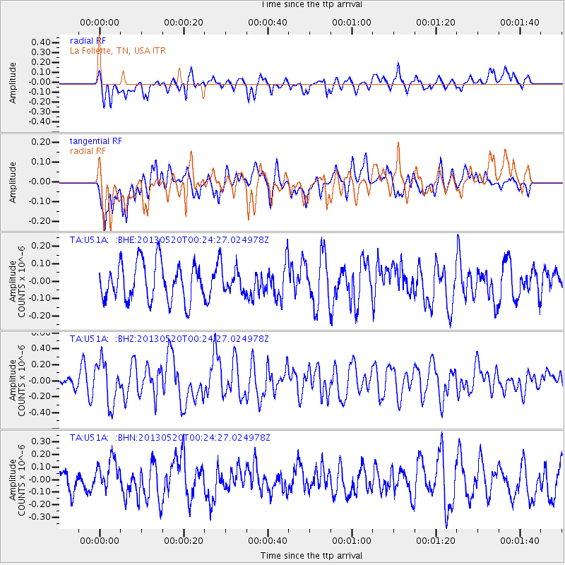
U51A La Follette, TN, USA - Earthquake Result Viewer
*The percent match for this event was below the threshold and hence no stack was calculated.
| Earthquake location: |
Off East Coast Of Kamchatka |
| Earthquake latitude/longitude: |
52.3/160.3 |
| Earthquake time(UTC): |
2013/05/20 (140) 00:13:17 GMT |
| Earthquake Depth: |
35 km |
| Earthquake Magnitude: |
5.5 MW, 5.5 MB |
| Earthquake Catalog/Contributor: |
NEIC PDE/NEIC PDE-W |
|
| Network: |
TA USArray Transportable Network (new EarthScope stations) |
| Station: |
U51A La Follette, TN, USA |
| Lat/Lon: |
36.38 N/84.02 W |
| Elevation: |
472 m |
|
| Distance: |
75.5 deg |
| Az: |
48.68 deg |
| Baz: |
325.104 deg |
| Ray Param: |
$rayparam |
*The percent match for this event was below the threshold and hence was not used in the summary stack. |
|
| Radial Match: |
67.76624 % |
| Radial Bump: |
400 |
| Transverse Match: |
60.648186 % |
| Transverse Bump: |
400 |
| SOD ConfigId: |
512894 |
| Insert Time: |
2013-09-14 10:00:42.694 +0000 |
| GWidth: |
2.5 |
| Max Bumps: |
400 |
| Tol: |
0.001 |
|
Signal To Noise
| Channel | StoN | STA | LTA |
| TA:U51A: :BHZ:20130520T00:24:27.024978Z | 2.4367836 | 2.709846E-7 | 1.1120586E-7 |
| TA:U51A: :BHN:20130520T00:24:27.024978Z | 1.2340267 | 1.2438419E-7 | 1.00795376E-7 |
| TA:U51A: :BHE:20130520T00:24:27.024978Z | 0.572333 | 6.227845E-8 | 1.0881507E-7 |
| Arrivals |
| Ps | |
| PpPs | |
| PsPs/PpSs | |


