You are here: Home > Network List > US - United States National Seismic Network Stations List
> Station AGMN Agassiz National Wildlife Refuge, Minnesota, USA > Earthquake Result Viewer
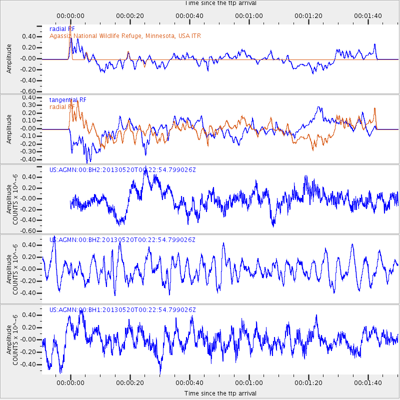
AGMN Agassiz National Wildlife Refuge, Minnesota, USA - Earthquake Result Viewer
*The percent match for this event was below the threshold and hence no stack was calculated.
| Earthquake location: |
Off East Coast Of Kamchatka |
| Earthquake latitude/longitude: |
52.3/160.3 |
| Earthquake time(UTC): |
2013/05/20 (140) 00:13:17 GMT |
| Earthquake Depth: |
35 km |
| Earthquake Magnitude: |
5.5 MW, 5.5 MB |
| Earthquake Catalog/Contributor: |
NEIC PDE/NEIC PDE-W |
|
| Network: |
US United States National Seismic Network |
| Station: |
AGMN Agassiz National Wildlife Refuge, Minnesota, USA |
| Lat/Lon: |
48.30 N/95.86 W |
| Elevation: |
351 m |
|
| Distance: |
60.7 deg |
| Az: |
47.993 deg |
| Baz: |
316.838 deg |
| Ray Param: |
$rayparam |
*The percent match for this event was below the threshold and hence was not used in the summary stack. |
|
| Radial Match: |
56.679127 % |
| Radial Bump: |
400 |
| Transverse Match: |
57.87919 % |
| Transverse Bump: |
400 |
| SOD ConfigId: |
512894 |
| Insert Time: |
2013-09-14 10:03:57.031 +0000 |
| GWidth: |
2.5 |
| Max Bumps: |
400 |
| Tol: |
0.001 |
|
Signal To Noise
| Channel | StoN | STA | LTA |
| US:AGMN:00:BHZ:20130520T00:22:54.799026Z | 0.70333606 | 9.8728684E-8 | 1.4037198E-7 |
| US:AGMN:00:BH1:20130520T00:22:54.799026Z | 1.7777079 | 3.4224348E-7 | 1.9251952E-7 |
| US:AGMN:00:BH2:20130520T00:22:54.799026Z | 1.3558321 | 2.6023747E-7 | 1.9193931E-7 |
| Arrivals |
| Ps | |
| PpPs | |
| PsPs/PpSs | |


