TBLG Delisi, Georgia - Earthquake Result Viewer
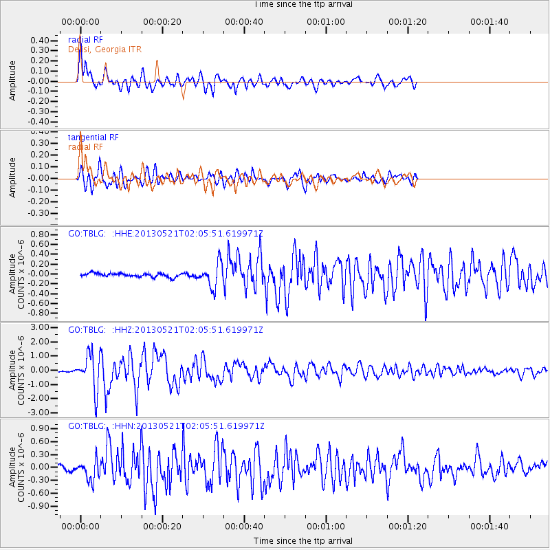
Earthquake location: Off East Coast Of Kamchatka
Earthquake latitude/longitude: 52.5/160.4
Earthquake time(UTC): 2013/05/21 (141) 01:55:08 GMT
Earthquake Depth: 30 km
Earthquake Magnitude: 6.0 MW, 5.6 MB, 5.7 MS, 5.9 MW
Earthquake Catalog/Contributor: NEIC PDE/NEIC PDE-W
Network: GO National Seismic Network of Georgia
Station: TBLG Delisi, Georgia
Lat/Lon: 41.73 N/44.74 E
Elevation: 510 m
Distance: 70.9 deg
Az: 314.424 deg
Baz: 35.665 deg
Ray Param: 0.05463053
Estimated Moho Depth: 65.5 km
Estimated Crust Vp/Vs: 1.60
Assumed Crust Vp: 6.291 km/s
Estimated Crust Vs: 3.932 km/s
Estimated Crust Poisson's Ratio: 0.18
Radial Match: 86.64047 %
Radial Bump: 400
Transverse Match: 86.480705 %
Transverse Bump: 400
SOD ConfigId: 512894
Insert Time: 2013-09-14 10:47:00.060 +0000
GWidth: 2.5
Max Bumps: 400
Tol: 0.001

Signal To Noise

ChannelStoNSTALTA
GO:TBLG: :HHZ:20130521T02:05:51.619971Z37.068211.3024667E-63.5137028E-8
GO:TBLG: :HHN:20130521T02:05:51.619971Z4.75141432.3954794E-75.0416137E-8
GO:TBLG: :HHE:20130521T02:05:51.619971Z6.61128142.5463657E-73.8515463E-8
Arrivals
Ps6.5 SECOND
PpPs26 SECOND
PsPs/PpSs33 SECOND