VTS Vitosha, Bulgary - Earthquake Result Viewer
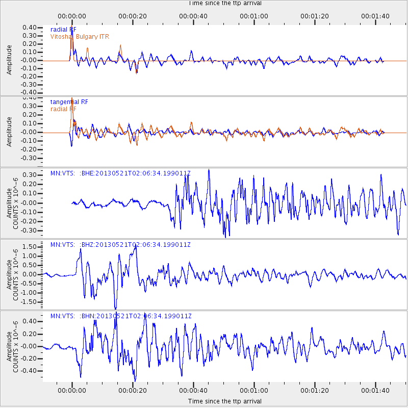
Earthquake location: Off East Coast Of Kamchatka
Earthquake latitude/longitude: 52.5/160.4
Earthquake time(UTC): 2013/05/21 (141) 01:55:08 GMT
Earthquake Depth: 30 km
Earthquake Magnitude: 6.0 MW, 5.6 MB, 5.7 MS, 5.9 MW
Earthquake Catalog/Contributor: NEIC PDE/NEIC PDE-W
Network: MN MEDNET Project
Station: VTS Vitosha, Bulgary
Lat/Lon: 42.62 N/23.24 E
Elevation: 1490 m
Distance: 78.3 deg
Az: 329.14 deg
Baz: 25.127 deg
Ray Param: 0.04972345
Estimated Moho Depth: 11.75 km
Estimated Crust Vp/Vs: 1.65
Assumed Crust Vp: 6.291 km/s
Estimated Crust Vs: 3.819 km/s
Estimated Crust Poisson's Ratio: 0.21
Radial Match: 93.859886 %
Radial Bump: 400
Transverse Match: 91.29341 %
Transverse Bump: 400
SOD ConfigId: 512894
Insert Time: 2013-09-14 10:52:56.921 +0000
GWidth: 2.5
Max Bumps: 400
Tol: 0.001

Signal To Noise

ChannelStoNSTALTA
MN:VTS: :BHZ:20130521T02:06:34.199011Z16.4056846.6023273E-74.0244146E-8
MN:VTS: :BHN:20130521T02:06:34.199011Z9.2705881.9966694E-72.1537678E-8
MN:VTS: :BHE:20130521T02:06:34.199011Z4.06926161.06979975E-72.6289777E-8
Arrivals
Ps1.2 SECOND
PpPs4.8 SECOND
PsPs/PpSs6.0 SECOND