You are here: Home > Network List > TA - USArray Transportable Network (new EarthScope stations) Stations List
> Station S45A Carrier Mills, IL, USA > Earthquake Result Viewer
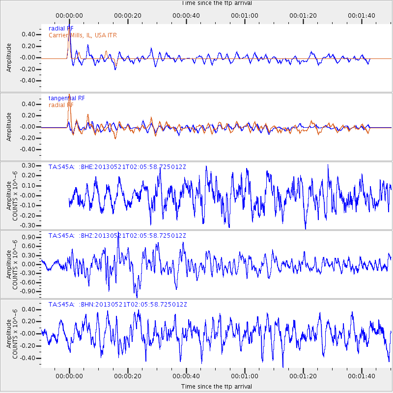
S45A Carrier Mills, IL, USA - Earthquake Result Viewer
*The percent match for this event was below the threshold and hence no stack was calculated.
| Earthquake location: |
Off East Coast Of Kamchatka |
| Earthquake latitude/longitude: |
52.5/160.4 |
| Earthquake time(UTC): |
2013/05/21 (141) 01:55:08 GMT |
| Earthquake Depth: |
30 km |
| Earthquake Magnitude: |
6.0 MW, 5.6 MB, 5.7 MS, 5.9 MW |
| Earthquake Catalog/Contributor: |
NEIC PDE/NEIC PDE-W |
|
| Network: |
TA USArray Transportable Network (new EarthScope stations) |
| Station: |
S45A Carrier Mills, IL, USA |
| Lat/Lon: |
37.68 N/88.58 W |
| Elevation: |
122 m |
|
| Distance: |
72.1 deg |
| Az: |
51.095 deg |
| Baz: |
323.18 deg |
| Ray Param: |
$rayparam |
*The percent match for this event was below the threshold and hence was not used in the summary stack. |
|
| Radial Match: |
74.3625 % |
| Radial Bump: |
400 |
| Transverse Match: |
64.84885 % |
| Transverse Bump: |
400 |
| SOD ConfigId: |
512894 |
| Insert Time: |
2013-09-14 11:09:07.941 +0000 |
| GWidth: |
2.5 |
| Max Bumps: |
400 |
| Tol: |
0.001 |
|
Signal To Noise
| Channel | StoN | STA | LTA |
| TA:S45A: :BHZ:20130521T02:05:58.725012Z | 2.2219594 | 2.183307E-7 | 9.826044E-8 |
| TA:S45A: :BHN:20130521T02:05:58.725012Z | 1.8129056 | 1.3023038E-7 | 7.183517E-8 |
| TA:S45A: :BHE:20130521T02:05:58.725012Z | 1.5083 | 1.2105305E-7 | 8.025794E-8 |
| Arrivals |
| Ps | |
| PpPs | |
| PsPs/PpSs | |


