You are here: Home > Network List > TA - USArray Transportable Network (new EarthScope stations) Stations List
> Station T46A Princeton, KY, USA > Earthquake Result Viewer
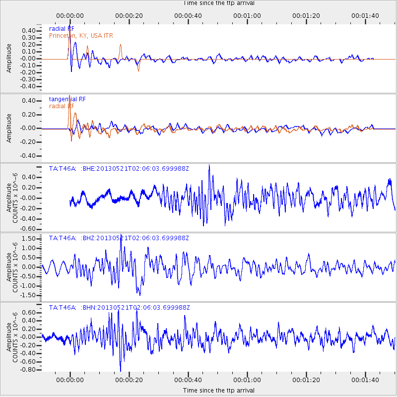
T46A Princeton, KY, USA - Earthquake Result Viewer
*The percent match for this event was below the threshold and hence no stack was calculated.
| Earthquake location: |
Off East Coast Of Kamchatka |
| Earthquake latitude/longitude: |
52.5/160.4 |
| Earthquake time(UTC): |
2013/05/21 (141) 01:55:08 GMT |
| Earthquake Depth: |
30 km |
| Earthquake Magnitude: |
6.0 MW, 5.6 MB, 5.7 MS, 5.9 MW |
| Earthquake Catalog/Contributor: |
NEIC PDE/NEIC PDE-W |
|
| Network: |
TA USArray Transportable Network (new EarthScope stations) |
| Station: |
T46A Princeton, KY, USA |
| Lat/Lon: |
37.04 N/87.89 W |
| Elevation: |
169 m |
|
| Distance: |
72.9 deg |
| Az: |
51.031 deg |
| Baz: |
323.576 deg |
| Ray Param: |
$rayparam |
*The percent match for this event was below the threshold and hence was not used in the summary stack. |
|
| Radial Match: |
78.06991 % |
| Radial Bump: |
400 |
| Transverse Match: |
59.146915 % |
| Transverse Bump: |
400 |
| SOD ConfigId: |
512894 |
| Insert Time: |
2013-09-14 11:09:48.814 +0000 |
| GWidth: |
2.5 |
| Max Bumps: |
400 |
| Tol: |
0.001 |
|
Signal To Noise
| Channel | StoN | STA | LTA |
| TA:T46A: :BHZ:20130521T02:06:03.699988Z | 2.2855875 | 3.2491178E-7 | 1.4215678E-7 |
| TA:T46A: :BHN:20130521T02:06:03.699988Z | 1.894833 | 1.533897E-7 | 8.095157E-8 |
| TA:T46A: :BHE:20130521T02:06:03.699988Z | 1.6597186 | 1.3826954E-7 | 8.3309025E-8 |
| Arrivals |
| Ps | |
| PpPs | |
| PsPs/PpSs | |


