You are here: Home > Network List > US - United States National Seismic Network Stations List
> Station MSO Missoula, Montana, USA > Earthquake Result Viewer
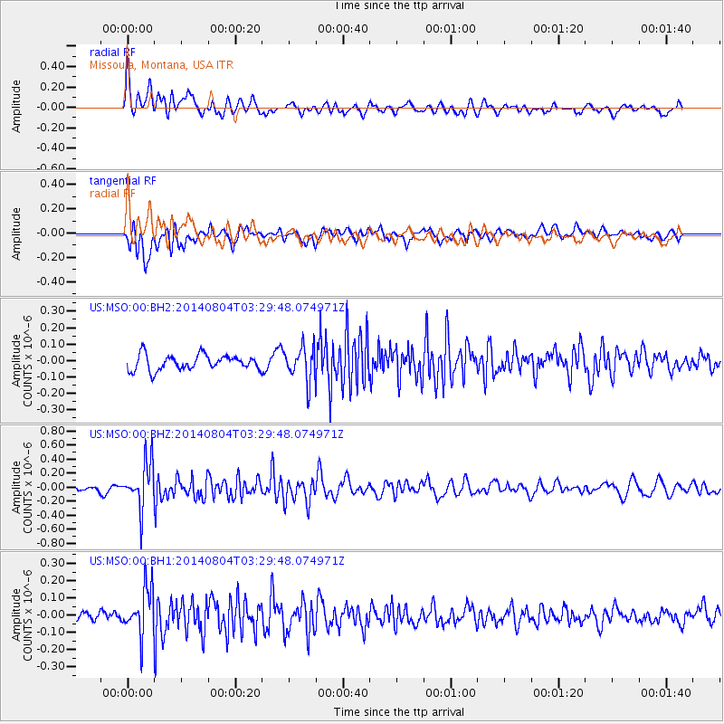
MSO Missoula, Montana, USA - Earthquake Result Viewer
*The percent match for this event was below the threshold and hence no stack was calculated.
| Earthquake location: |
Near Coast Of Northern Peru |
| Earthquake latitude/longitude: |
-6.9/-81.6 |
| Earthquake time(UTC): |
2014/08/04 (216) 03:20:09 GMT |
| Earthquake Depth: |
23 km |
| Earthquake Magnitude: |
5.3 MW, 5.4 mb, 5.3 Mwb |
| Earthquake Catalog/Contributor: |
ISC/ISC |
|
| Network: |
US United States National Seismic Network |
| Station: |
MSO Missoula, Montana, USA |
| Lat/Lon: |
46.83 N/113.94 W |
| Elevation: |
1264 m |
|
| Distance: |
60.7 deg |
| Az: |
335.102 deg |
| Baz: |
142.5 deg |
| Ray Param: |
$rayparam |
*The percent match for this event was below the threshold and hence was not used in the summary stack. |
|
| Radial Match: |
74.8241 % |
| Radial Bump: |
400 |
| Transverse Match: |
62.81151 % |
| Transverse Bump: |
400 |
| SOD ConfigId: |
3390531 |
| Insert Time: |
2019-04-13 05:08:11.395 +0000 |
| GWidth: |
2.5 |
| Max Bumps: |
400 |
| Tol: |
0.001 |
|
Signal To Noise
| Channel | StoN | STA | LTA |
| US:MSO:00:BHZ:20140804T03:29:48.074971Z | 9.153658 | 3.2718228E-7 | 3.574334E-8 |
| US:MSO:00:BH1:20140804T03:29:48.074971Z | 3.128879 | 1.3736923E-7 | 4.3903654E-8 |
| US:MSO:00:BH2:20140804T03:29:48.074971Z | 2.2509394 | 1.04040154E-7 | 4.622077E-8 |
| Arrivals |
| Ps | |
| PpPs | |
| PsPs/PpSs | |


