You are here: Home > Network List > UW - Pacific Northwest Regional Seismic Network Stations List
> Station LEBA Lebam, WA, USA > Earthquake Result Viewer
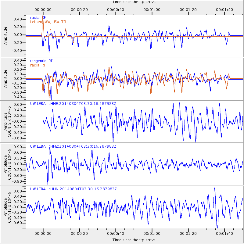
LEBA Lebam, WA, USA - Earthquake Result Viewer
*The percent match for this event was below the threshold and hence no stack was calculated.
| Earthquake location: |
Near Coast Of Northern Peru |
| Earthquake latitude/longitude: |
-6.9/-81.6 |
| Earthquake time(UTC): |
2014/08/04 (216) 03:20:09 GMT |
| Earthquake Depth: |
23 km |
| Earthquake Magnitude: |
5.3 MW, 5.4 mb, 5.3 Mwb |
| Earthquake Catalog/Contributor: |
ISC/ISC |
|
| Network: |
UW Pacific Northwest Regional Seismic Network |
| Station: |
LEBA Lebam, WA, USA |
| Lat/Lon: |
46.55 N/123.56 W |
| Elevation: |
73 m |
|
| Distance: |
65.0 deg |
| Az: |
329.386 deg |
| Baz: |
132.901 deg |
| Ray Param: |
$rayparam |
*The percent match for this event was below the threshold and hence was not used in the summary stack. |
|
| Radial Match: |
62.510605 % |
| Radial Bump: |
400 |
| Transverse Match: |
63.442013 % |
| Transverse Bump: |
400 |
| SOD ConfigId: |
3390531 |
| Insert Time: |
2019-04-13 05:08:52.744 +0000 |
| GWidth: |
2.5 |
| Max Bumps: |
400 |
| Tol: |
0.001 |
|
Signal To Noise
| Channel | StoN | STA | LTA |
| UW:LEBA: :HHZ:20140804T03:30:16.287983Z | 2.6033213 | 4.3920622E-7 | 1.6870996E-7 |
| UW:LEBA: :HHN:20140804T03:30:16.287983Z | 0.53843325 | 1.3125305E-7 | 2.4376845E-7 |
| UW:LEBA: :HHE:20140804T03:30:16.287983Z | 1.184775 | 2.2912323E-7 | 1.9338967E-7 |
| Arrivals |
| Ps | |
| PpPs | |
| PsPs/PpSs | |


