You are here: Home > Network List > IU - Global Seismograph Network (GSN - IRIS/USGS) Stations List
> Station CCM Cathedral Cave, Missouri, USA > Earthquake Result Viewer
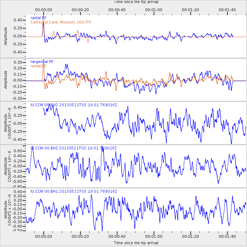
CCM Cathedral Cave, Missouri, USA - Earthquake Result Viewer
*The percent match for this event was below the threshold and hence no stack was calculated.
| Earthquake location: |
Off East Coast Of Kamchatka |
| Earthquake latitude/longitude: |
52.5/160.1 |
| Earthquake time(UTC): |
2013/05/21 (141) 03:08:17 GMT |
| Earthquake Depth: |
7.6 km |
| Earthquake Magnitude: |
5.8 MW, 5.6 MB, 5.7 MW, 5.8 MS |
| Earthquake Catalog/Contributor: |
NEIC PDE/NEIC PDE-W |
|
| Network: |
IU Global Seismograph Network (GSN - IRIS/USGS) |
| Station: |
CCM Cathedral Cave, Missouri, USA |
| Lat/Lon: |
38.06 N/91.24 W |
| Elevation: |
222 m |
|
| Distance: |
70.6 deg |
| Az: |
52.469 deg |
| Baz: |
322.106 deg |
| Ray Param: |
$rayparam |
*The percent match for this event was below the threshold and hence was not used in the summary stack. |
|
| Radial Match: |
58.87931 % |
| Radial Bump: |
400 |
| Transverse Match: |
41.635017 % |
| Transverse Bump: |
400 |
| SOD ConfigId: |
512894 |
| Insert Time: |
2013-09-14 12:11:49.107 +0000 |
| GWidth: |
2.5 |
| Max Bumps: |
400 |
| Tol: |
0.001 |
|
Signal To Noise
| Channel | StoN | STA | LTA |
| IU:CCM:00:BHZ:20130521T03:19:01.769016Z | 0.90761304 | 2.669244E-7 | 2.9409495E-7 |
| IU:CCM:00:BH1:20130521T03:19:01.769016Z | 0.52574044 | 1.2693182E-7 | 2.4143438E-7 |
| IU:CCM:00:BH2:20130521T03:19:01.769016Z | 1.158687 | 2.3493958E-7 | 2.0276363E-7 |
| Arrivals |
| Ps | |
| PpPs | |
| PsPs/PpSs | |


