You are here: Home > Network List > X812 - Deep Structure of Three Continental Sutures in Eastern North America Stations List
> Station QM20 Hay Lake, Maine, USA > Earthquake Result Viewer
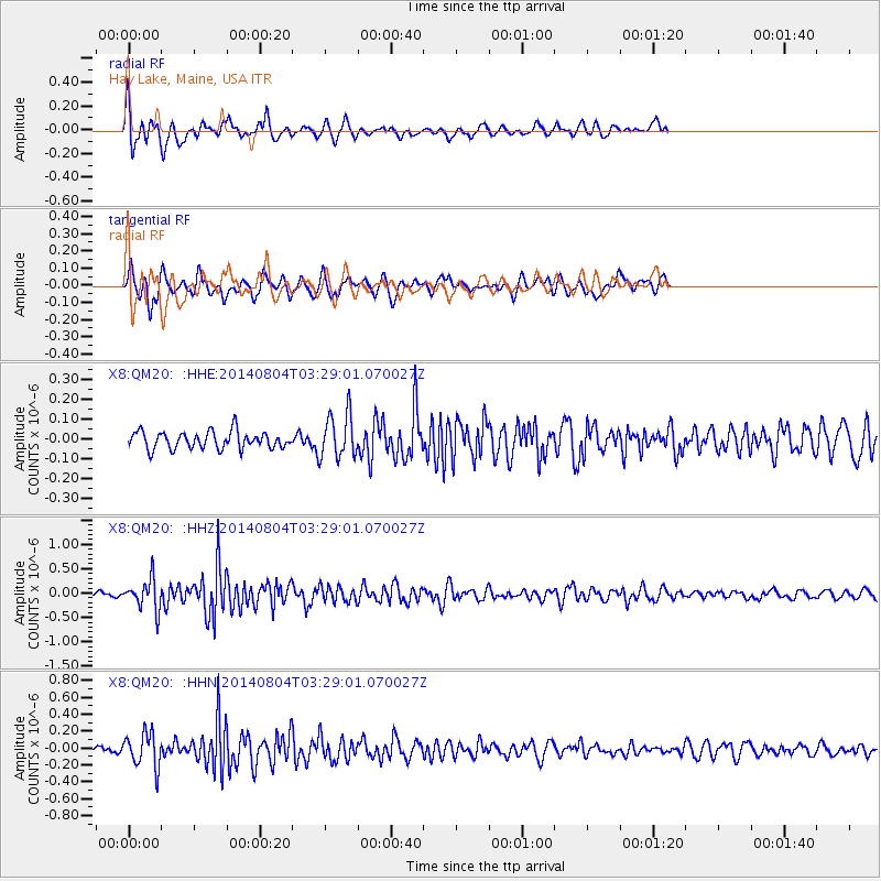
QM20 Hay Lake, Maine, USA - Earthquake Result Viewer
*The percent match for this event was below the threshold and hence no stack was calculated.
| Earthquake location: |
Near Coast Of Northern Peru |
| Earthquake latitude/longitude: |
-6.9/-81.6 |
| Earthquake time(UTC): |
2014/08/04 (216) 03:20:09 GMT |
| Earthquake Depth: |
23 km |
| Earthquake Magnitude: |
5.3 MW, 5.4 mb, 5.3 Mwb |
| Earthquake Catalog/Contributor: |
ISC/ISC |
|
| Network: |
X8 Deep Structure of Three Continental Sutures in Eastern North America |
| Station: |
QM20 Hay Lake, Maine, USA |
| Lat/Lon: |
46.13 N/68.72 W |
| Elevation: |
207 m |
|
| Distance: |
54.0 deg |
| Az: |
11.046 deg |
| Baz: |
195.874 deg |
| Ray Param: |
$rayparam |
*The percent match for this event was below the threshold and hence was not used in the summary stack. |
|
| Radial Match: |
70.79669 % |
| Radial Bump: |
400 |
| Transverse Match: |
63.81871 % |
| Transverse Bump: |
371 |
| SOD ConfigId: |
3390531 |
| Insert Time: |
2019-04-13 05:09:32.587 +0000 |
| GWidth: |
2.5 |
| Max Bumps: |
400 |
| Tol: |
0.001 |
|
Signal To Noise
| Channel | StoN | STA | LTA |
| X8:QM20: :HHZ:20140804T03:29:01.070027Z | 4.380605 | 3.1798191E-7 | 7.258858E-8 |
| X8:QM20: :HHN:20140804T03:29:01.070027Z | 3.6667504 | 2.0185354E-7 | 5.5049707E-8 |
| X8:QM20: :HHE:20140804T03:29:01.070027Z | 2.6119323 | 1.11925935E-7 | 4.2851774E-8 |
| Arrivals |
| Ps | |
| PpPs | |
| PsPs/PpSs | |


