You are here: Home > Network List > GO - National Seismic Network of Georgia Stations List
> Station TBLG Delisi, Georgia > Earthquake Result Viewer
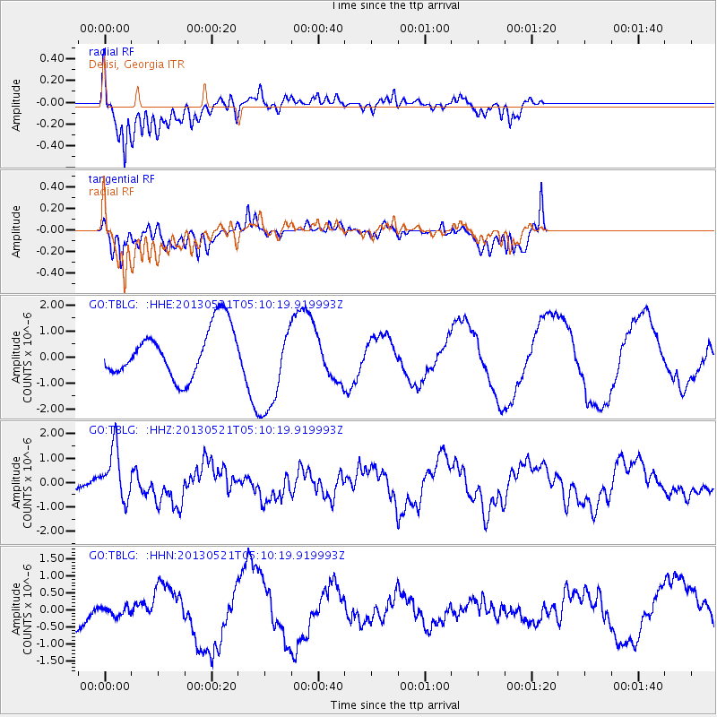
TBLG Delisi, Georgia - Earthquake Result Viewer

| Earthquake location: |
Off East Coast Of Kamchatka |
| Earthquake latitude/longitude: |
52.3/160.1 |
| Earthquake time(UTC): |
2013/05/21 (141) 04:59:35 GMT |
| Earthquake Depth: |
18 km |
| Earthquake Magnitude: |
5.7 MW, 5.6 MS, 5.7 MW |
| Earthquake Catalog/Contributor: |
NEIC PDE/NEIC PDE-W |
|
| Network: |
GO National Seismic Network of Georgia |
| Station: |
TBLG Delisi, Georgia |
| Lat/Lon: |
41.73 N/44.74 E |
| Elevation: |
510 m |
|
| Distance: |
70.9 deg |
| Az: |
314.275 deg |
| Baz: |
35.932 deg |
| Ray Param: |
0.054663785 |
| Estimated Moho Depth: |
11.25 km |
| Estimated Crust Vp/Vs: |
1.61 |
| Assumed Crust Vp: |
6.291 km/s |
| Estimated Crust Vs: |
3.901 km/s |
| Estimated Crust Poisson's Ratio: |
0.19 |
|
| Radial Match: |
82.55242 % |
| Radial Bump: |
400 |
| Transverse Match: |
41.761646 % |
| Transverse Bump: |
348 |
| SOD ConfigId: |
512894 |
| Insert Time: |
2013-09-14 12:49:03.691 +0000 |
| GWidth: |
2.5 |
| Max Bumps: |
400 |
| Tol: |
0.001 |
|
Signal To Noise
| Channel | StoN | STA | LTA |
| GO:TBLG: :HHZ:20130521T05:10:19.919993Z | 2.2288022 | 1.0858181E-6 | 4.871756E-7 |
| GO:TBLG: :HHN:20130521T05:10:19.919993Z | 0.18408383 | 1.295352E-7 | 7.0367497E-7 |
| GO:TBLG: :HHE:20130521T05:10:19.919993Z | 1.8829858 | 1.7619338E-6 | 9.357128E-7 |
| Arrivals |
| Ps | 1.1 SECOND |
| PpPs | 4.5 SECOND |
| PsPs/PpSs | 5.6 SECOND |


