You are here: Home > Network List > TA - USArray Transportable Network (new EarthScope stations) Stations List
> Station E46A Sault Ste Marie, MI, USA > Earthquake Result Viewer
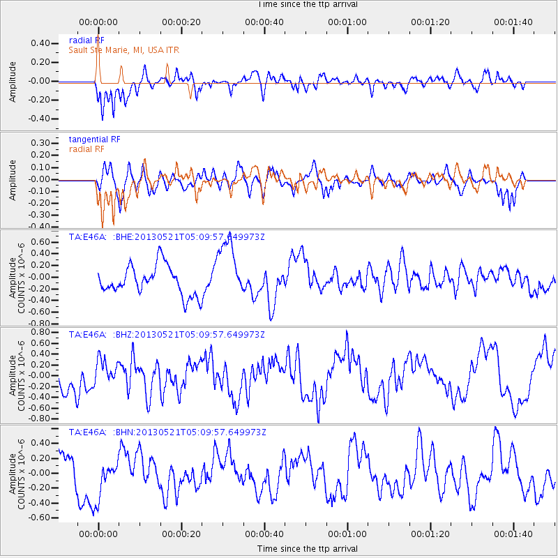
E46A Sault Ste Marie, MI, USA - Earthquake Result Viewer
*The percent match for this event was below the threshold and hence no stack was calculated.
| Earthquake location: |
Off East Coast Of Kamchatka |
| Earthquake latitude/longitude: |
52.3/160.1 |
| Earthquake time(UTC): |
2013/05/21 (141) 04:59:35 GMT |
| Earthquake Depth: |
18 km |
| Earthquake Magnitude: |
5.7 MW, 5.6 MS, 5.7 MW |
| Earthquake Catalog/Contributor: |
NEIC PDE/NEIC PDE-W |
|
| Network: |
TA USArray Transportable Network (new EarthScope stations) |
| Station: |
E46A Sault Ste Marie, MI, USA |
| Lat/Lon: |
46.37 N/84.31 W |
| Elevation: |
269 m |
|
| Distance: |
67.3 deg |
| Az: |
42.592 deg |
| Baz: |
323.161 deg |
| Ray Param: |
$rayparam |
*The percent match for this event was below the threshold and hence was not used in the summary stack. |
|
| Radial Match: |
71.55971 % |
| Radial Bump: |
400 |
| Transverse Match: |
66.734436 % |
| Transverse Bump: |
400 |
| SOD ConfigId: |
512894 |
| Insert Time: |
2013-09-14 13:04:24.515 +0000 |
| GWidth: |
2.5 |
| Max Bumps: |
400 |
| Tol: |
0.001 |
|
Signal To Noise
| Channel | StoN | STA | LTA |
| TA:E46A: :BHZ:20130521T05:09:57.649973Z | 0.9631891 | 2.4064133E-7 | 2.498381E-7 |
| TA:E46A: :BHN:20130521T05:09:57.649973Z | 0.789149 | 2.5970184E-7 | 3.29091E-7 |
| TA:E46A: :BHE:20130521T05:09:57.649973Z | 2.087643 | 5.179364E-7 | 2.4809626E-7 |
| Arrivals |
| Ps | |
| PpPs | |
| PsPs/PpSs | |


