You are here: Home > Network List > TA - USArray Transportable Network (new EarthScope stations) Stations List
> Station I39A Houston, MN, USA > Earthquake Result Viewer
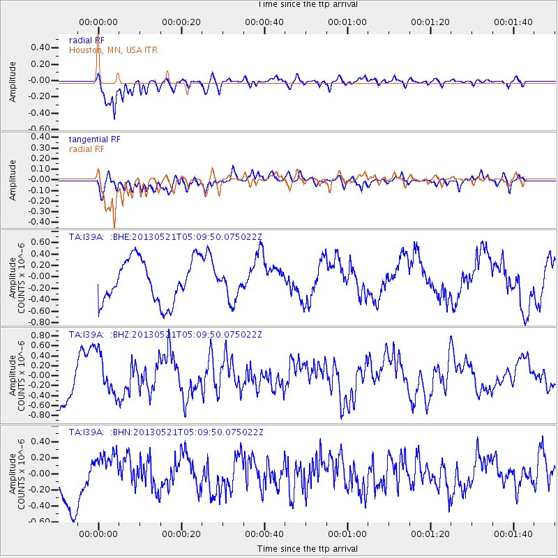
I39A Houston, MN, USA - Earthquake Result Viewer
*The percent match for this event was below the threshold and hence no stack was calculated.
| Earthquake location: |
Off East Coast Of Kamchatka |
| Earthquake latitude/longitude: |
52.3/160.1 |
| Earthquake time(UTC): |
2013/05/21 (141) 04:59:35 GMT |
| Earthquake Depth: |
18 km |
| Earthquake Magnitude: |
5.7 MW, 5.6 MS, 5.7 MW |
| Earthquake Catalog/Contributor: |
NEIC PDE/NEIC PDE-W |
|
| Network: |
TA USArray Transportable Network (new EarthScope stations) |
| Station: |
I39A Houston, MN, USA |
| Lat/Lon: |
43.85 N/91.52 W |
| Elevation: |
393 m |
|
| Distance: |
66.1 deg |
| Az: |
48.653 deg |
| Baz: |
320.46 deg |
| Ray Param: |
$rayparam |
*The percent match for this event was below the threshold and hence was not used in the summary stack. |
|
| Radial Match: |
84.87897 % |
| Radial Bump: |
365 |
| Transverse Match: |
67.01653 % |
| Transverse Bump: |
400 |
| SOD ConfigId: |
512894 |
| Insert Time: |
2013-09-14 13:06:18.628 +0000 |
| GWidth: |
2.5 |
| Max Bumps: |
400 |
| Tol: |
0.001 |
|
Signal To Noise
| Channel | StoN | STA | LTA |
| TA:I39A: :BHZ:20130521T05:09:50.075022Z | 0.7532336 | 4.2100405E-7 | 5.5892895E-7 |
| TA:I39A: :BHN:20130521T05:09:50.075022Z | 0.6476571 | 2.8462262E-7 | 4.39465E-7 |
| TA:I39A: :BHE:20130521T05:09:50.075022Z | 0.7112089 | 2.647509E-7 | 3.7225476E-7 |
| Arrivals |
| Ps | |
| PpPs | |
| PsPs/PpSs | |


