You are here: Home > Network List > TA - USArray Transportable Network (new EarthScope stations) Stations List
> Station R58A Rapidan, VA, USA > Earthquake Result Viewer
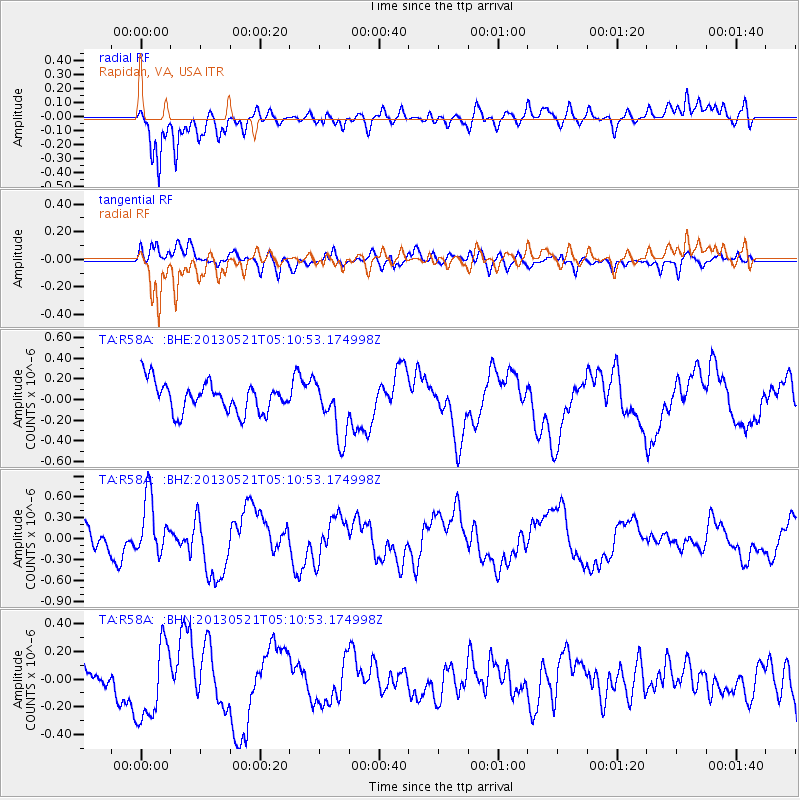
R58A Rapidan, VA, USA - Earthquake Result Viewer
*The percent match for this event was below the threshold and hence no stack was calculated.
| Earthquake location: |
Off East Coast Of Kamchatka |
| Earthquake latitude/longitude: |
52.3/160.1 |
| Earthquake time(UTC): |
2013/05/21 (141) 04:59:35 GMT |
| Earthquake Depth: |
18 km |
| Earthquake Magnitude: |
5.7 MW, 5.6 MS, 5.7 MW |
| Earthquake Catalog/Contributor: |
NEIC PDE/NEIC PDE-W |
|
| Network: |
TA USArray Transportable Network (new EarthScope stations) |
| Station: |
R58A Rapidan, VA, USA |
| Lat/Lon: |
38.30 N/78.00 W |
| Elevation: |
184 m |
|
| Distance: |
76.6 deg |
| Az: |
43.352 deg |
| Baz: |
327.64 deg |
| Ray Param: |
$rayparam |
*The percent match for this event was below the threshold and hence was not used in the summary stack. |
|
| Radial Match: |
75.361206 % |
| Radial Bump: |
400 |
| Transverse Match: |
64.42406 % |
| Transverse Bump: |
400 |
| SOD ConfigId: |
512894 |
| Insert Time: |
2013-09-14 13:11:51.824 +0000 |
| GWidth: |
2.5 |
| Max Bumps: |
400 |
| Tol: |
0.001 |
|
Signal To Noise
| Channel | StoN | STA | LTA |
| TA:R58A: :BHZ:20130521T05:10:53.174998Z | 3.3024838 | 4.1493584E-7 | 1.2564357E-7 |
| TA:R58A: :BHN:20130521T05:10:53.174998Z | 2.0928583 | 2.8453618E-7 | 1.3595579E-7 |
| TA:R58A: :BHE:20130521T05:10:53.174998Z | 1.9822571 | 2.838724E-7 | 1.4320665E-7 |
| Arrivals |
| Ps | |
| PpPs | |
| PsPs/PpSs | |


