You are here: Home > Network List > NE - New England Seismic Network Stations List
> Station EMMW Machias, ME, USA > Earthquake Result Viewer
EMMW Machias, ME, USA - Earthquake Result Viewer
*The percent match for this event was below the threshold and hence no stack was calculated.
| Earthquake location: |
Off East Coast Of Kamchatka |
| Earthquake latitude/longitude: |
52.3/160.1 |
| Earthquake time(UTC): |
2013/05/21 (141) 05:43:21 GMT |
| Earthquake Depth: |
30 km |
| Earthquake Magnitude: |
6.1 MW, 5.8 MB, 6.1 MS, 6.1 MW |
| Earthquake Catalog/Contributor: |
NEIC PDE/NEIC PDE-W |
|
| Network: |
NE New England Seismic Network |
| Station: |
EMMW Machias, ME, USA |
| Lat/Lon: |
44.71 N/67.46 W |
| Elevation: |
35 m |
|
| Distance: |
75.1 deg |
| Az: |
32.978 deg |
| Baz: |
332.033 deg |
| Ray Param: |
$rayparam |
*The percent match for this event was below the threshold and hence was not used in the summary stack. |
|
| Radial Match: |
75.96961 % |
| Radial Bump: |
400 |
| Transverse Match: |
64.51508 % |
| Transverse Bump: |
400 |
| SOD ConfigId: |
512894 |
| Insert Time: |
2013-09-14 13:36:31.253 +0000 |
| GWidth: |
2.5 |
| Max Bumps: |
400 |
| Tol: |
0.001 |
|
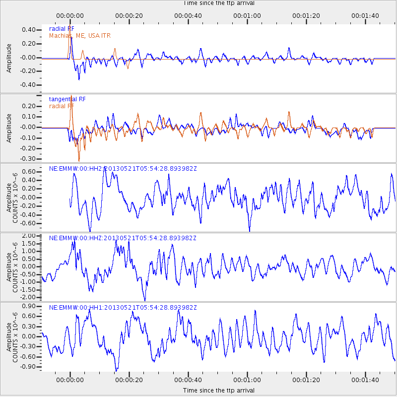
Signal To Noise
| Channel | StoN | STA | LTA |
| NE:EMMW:00:HHZ:20130521T05:54:28.893982Z | 1.7766552 | 9.505145E-7 | 5.3500224E-7 |
| NE:EMMW:00:HH1:20130521T05:54:28.893982Z | 1.2429683 | 3.7111738E-7 | 2.9857347E-7 |
| NE:EMMW:00:HH2:20130521T05:54:28.893982Z | 0.7800374 | 2.778818E-7 | 3.5624166E-7 |
| Arrivals |
| Ps | |
| PpPs | |
| PsPs/PpSs | |


