You are here: Home > Network List > TA - USArray Transportable Network (new EarthScope stations) Stations List
> Station I39A Houston, MN, USA > Earthquake Result Viewer
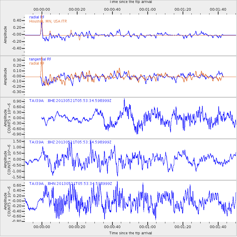
I39A Houston, MN, USA - Earthquake Result Viewer
*The percent match for this event was below the threshold and hence no stack was calculated.
| Earthquake location: |
Off East Coast Of Kamchatka |
| Earthquake latitude/longitude: |
52.3/160.1 |
| Earthquake time(UTC): |
2013/05/21 (141) 05:43:21 GMT |
| Earthquake Depth: |
30 km |
| Earthquake Magnitude: |
6.1 MW, 5.8 MB, 6.1 MS, 6.1 MW |
| Earthquake Catalog/Contributor: |
NEIC PDE/NEIC PDE-W |
|
| Network: |
TA USArray Transportable Network (new EarthScope stations) |
| Station: |
I39A Houston, MN, USA |
| Lat/Lon: |
43.85 N/91.52 W |
| Elevation: |
393 m |
|
| Distance: |
66.1 deg |
| Az: |
48.637 deg |
| Baz: |
320.403 deg |
| Ray Param: |
$rayparam |
*The percent match for this event was below the threshold and hence was not used in the summary stack. |
|
| Radial Match: |
62.53349 % |
| Radial Bump: |
400 |
| Transverse Match: |
63.667583 % |
| Transverse Bump: |
368 |
| SOD ConfigId: |
512894 |
| Insert Time: |
2013-09-14 13:47:14.707 +0000 |
| GWidth: |
2.5 |
| Max Bumps: |
400 |
| Tol: |
0.001 |
|
Signal To Noise
| Channel | StoN | STA | LTA |
| TA:I39A: :BHZ:20130521T05:53:34.598999Z | 2.8848155 | 4.9991024E-7 | 1.732902E-7 |
| TA:I39A: :BHN:20130521T05:53:34.598999Z | 1.2690957 | 2.7314385E-7 | 2.1522717E-7 |
| TA:I39A: :BHE:20130521T05:53:34.598999Z | 2.2664897 | 3.3348658E-7 | 1.4713792E-7 |
| Arrivals |
| Ps | |
| PpPs | |
| PsPs/PpSs | |


