
TSK Tsukuba, Japan - Earthquake Result Viewer
| ||||||||||||||||||
| ||||||||||||||||||
| ||||||||||||||||||
|
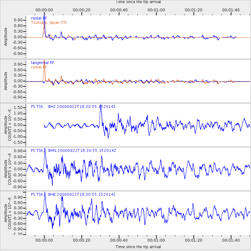
Signal To Noise
| Channel | StoN | STA | LTA |
| PS:TSK: :BHN:20000922T18:30:55.152014Z | 3.4115798 | 4.4176596E-7 | 1.2949013E-7 |
| PS:TSK: :BHE:20000922T18:30:55.152014Z | 5.0164914 | 5.1480345E-7 | 1.0262222E-7 |
| PS:TSK: :BHZ:20000922T18:30:55.152014Z | 6.491832 | 7.47937E-7 | 1.1521202E-7 |
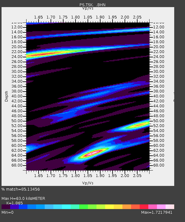
| Arrivals | |
| Ps | 9.2 SECOND |
| PpPs | 28 SECOND |
| PsPs/PpSs | 37 SECOND |

