You are here: Home > Network List > TJ - Tajikistan National Seismic Network Stations List
> Station GARM Garm, Tajikistan > Earthquake Result Viewer
GARM Garm, Tajikistan - Earthquake Result Viewer
*The percent match for this event was below the threshold and hence no stack was calculated.
| Earthquake location: |
Southwestern Ryukyu Isl., Japan |
| Earthquake latitude/longitude: |
23.4/123.7 |
| Earthquake time(UTC): |
2013/05/21 (141) 08:25:53 GMT |
| Earthquake Depth: |
10 km |
| Earthquake Magnitude: |
5.6 MB |
| Earthquake Catalog/Contributor: |
NEIC PDE/NEIC PDE-W |
|
| Network: |
TJ Tajikistan National Seismic Network |
| Station: |
GARM Garm, Tajikistan |
| Lat/Lon: |
39.00 N/70.32 E |
| Elevation: |
1305 m |
|
| Distance: |
47.6 deg |
| Az: |
302.111 deg |
| Baz: |
92.805 deg |
| Ray Param: |
$rayparam |
*The percent match for this event was below the threshold and hence was not used in the summary stack. |
|
| Radial Match: |
74.168976 % |
| Radial Bump: |
400 |
| Transverse Match: |
72.53978 % |
| Transverse Bump: |
400 |
| SOD ConfigId: |
512894 |
| Insert Time: |
2013-09-14 14:15:42.856 +0000 |
| GWidth: |
2.5 |
| Max Bumps: |
400 |
| Tol: |
0.001 |
|
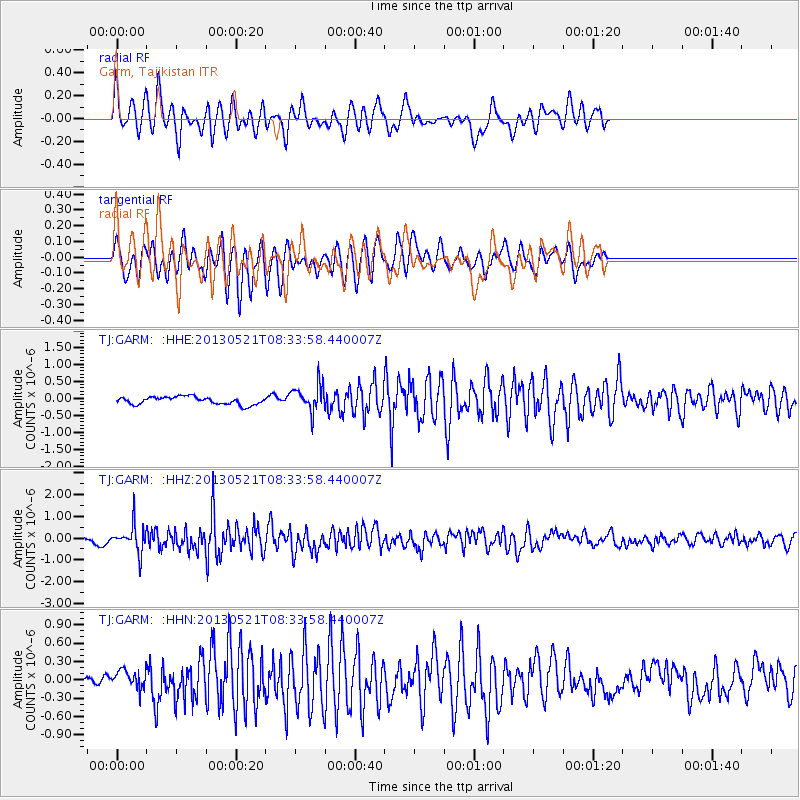
Signal To Noise
| Channel | StoN | STA | LTA |
| TJ:GARM: :HHZ:20130521T08:33:58.440007Z | 2.863413 | 6.2097297E-7 | 2.1686462E-7 |
| TJ:GARM: :HHN:20130521T08:33:58.440007Z | 1.260187 | 1.5362723E-7 | 1.2190827E-7 |
| TJ:GARM: :HHE:20130521T08:33:58.440007Z | 3.5012264 | 3.9383133E-7 | 1.12483825E-7 |
| Arrivals |
| Ps | |
| PpPs | |
| PsPs/PpSs | |


