TSK Tsukuba, Japan - Earthquake Result Viewer
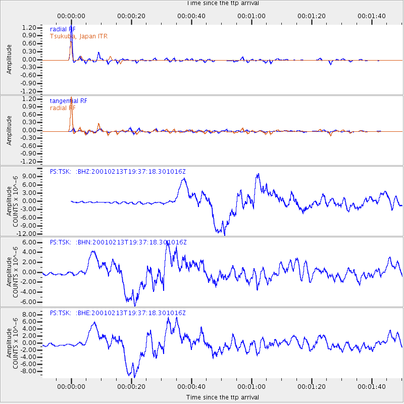
Earthquake location: Southern Sumatra, Indonesia
Earthquake latitude/longitude: -4.7/102.6
Earthquake time(UTC): 2001/02/13 (044) 19:28:30 GMT
Earthquake Depth: 36 km
Earthquake Magnitude: 6.2 MB, 7.2 MS, 7.4 MW, 7.0 ME
Earthquake Catalog/Contributor: WHDF/NEIC
Network: PS Pacific21
Station: TSK Tsukuba, Japan
Lat/Lon: 36.21 N/140.11 E
Elevation: 350 m
Distance: 53.7 deg
Az: 37.677 deg
Baz: 228.875 deg
Ray Param: 0.065824084
Estimated Moho Depth: 63.5 km
Estimated Crust Vp/Vs: 1.86
Assumed Crust Vp: 6.24 km/s
Estimated Crust Vs: 3.359 km/s
Estimated Crust Poisson's Ratio: 0.30
Radial Match: 98.04726 %
Radial Bump: 257
Transverse Match: 83.23697 %
Transverse Bump: 400
SOD ConfigId: 3744
Insert Time: 2010-02-27 03:48:05.354 +0000
GWidth: 2.5
Max Bumps: 400
Tol: 0.001

Signal To Noise

ChannelStoNSTALTA
PS:TSK: :BHN:20010213T19:37:18.301016Z1.339452.627307E-71.961482E-7
PS:TSK: :BHE:20010213T19:37:18.301016Z1.03938932.804011E-72.6977486E-7
PS:TSK: :BHZ:20010213T19:37:18.301016Z1.44286123.8283062E-72.653274E-7
Arrivals
Ps9.2 SECOND
PpPs28 SECOND
PsPs/PpSs37 SECOND