You are here: Home > Network List > IW - Intermountain West Stations List
> Station MOOW Moose Ponds, Wyoming, USA > Earthquake Result Viewer
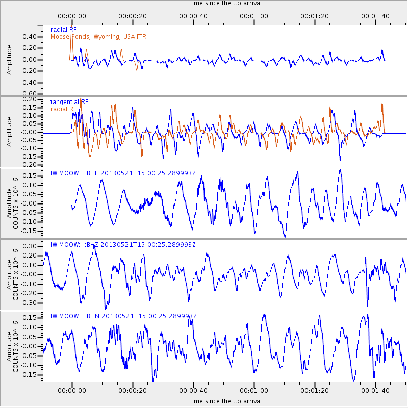
MOOW Moose Ponds, Wyoming, USA - Earthquake Result Viewer
*The percent match for this event was below the threshold and hence no stack was calculated.
| Earthquake location: |
Off East Coast Of Kamchatka |
| Earthquake latitude/longitude: |
52.6/160.6 |
| Earthquake time(UTC): |
2013/05/21 (141) 14:51:19 GMT |
| Earthquake Depth: |
37 km |
| Earthquake Magnitude: |
5.6 MW, 5.5 MW |
| Earthquake Catalog/Contributor: |
NEIC PDE/NEIC PDE-W |
|
| Network: |
IW Intermountain West |
| Station: |
MOOW Moose Ponds, Wyoming, USA |
| Lat/Lon: |
43.75 N/110.74 W |
| Elevation: |
2128 m |
|
| Distance: |
56.2 deg |
| Az: |
60.7 deg |
| Baz: |
312.763 deg |
| Ray Param: |
$rayparam |
*The percent match for this event was below the threshold and hence was not used in the summary stack. |
|
| Radial Match: |
62.910416 % |
| Radial Bump: |
400 |
| Transverse Match: |
62.426674 % |
| Transverse Bump: |
400 |
| SOD ConfigId: |
512894 |
| Insert Time: |
2013-09-14 14:33:04.776 +0000 |
| GWidth: |
2.5 |
| Max Bumps: |
400 |
| Tol: |
0.001 |
|
Signal To Noise
| Channel | StoN | STA | LTA |
| IW:MOOW: :BHZ:20130521T15:00:25.289993Z | 1.7195346 | 1.8364541E-7 | 1.0679948E-7 |
| IW:MOOW: :BHN:20130521T15:00:25.289993Z | 1.7051132 | 6.963896E-8 | 4.084125E-8 |
| IW:MOOW: :BHE:20130521T15:00:25.289993Z | 1.0723779 | 6.722025E-8 | 6.2683355E-8 |
| Arrivals |
| Ps | |
| PpPs | |
| PsPs/PpSs | |


