TSK Tsukuba, Japan - Earthquake Result Viewer
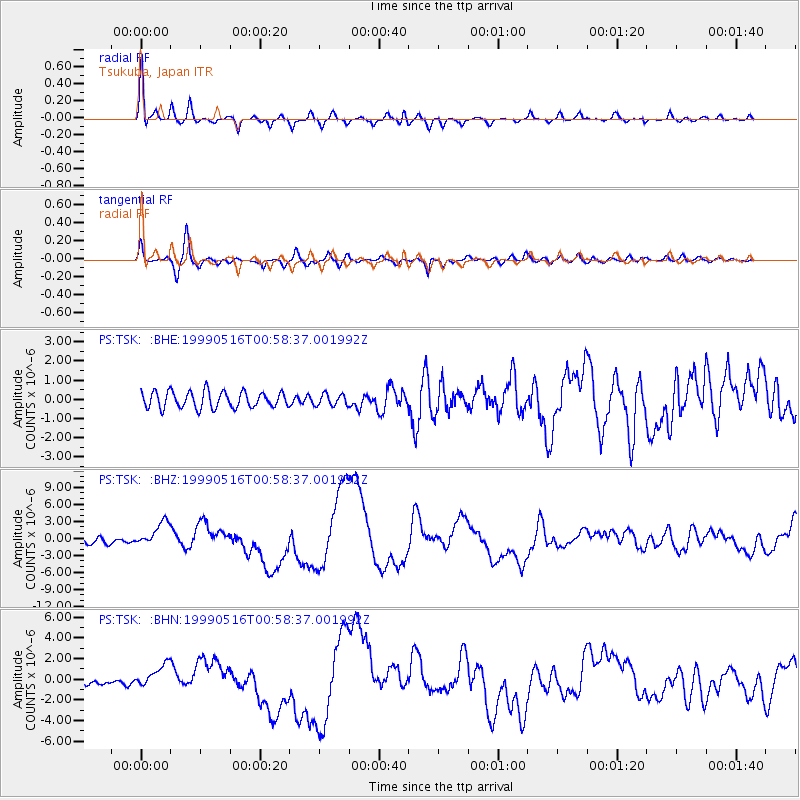
Earthquake location: New Britain Region, P.N.G.
Earthquake latitude/longitude: -4.8/152.5
Earthquake time(UTC): 1999/05/16 (136) 00:51:20 GMT
Earthquake Depth: 74 km
Earthquake Magnitude: 6.0 MB, 7.0 MS, 7.1 MW, 6.3 ME
Earthquake Catalog/Contributor: WHDF/NEIC
Network: PS Pacific21
Station: TSK Tsukuba, Japan
Lat/Lon: 36.21 N/140.11 E
Elevation: 350 m
Distance: 42.4 deg
Az: 345.094 deg
Baz: 161.519 deg
Ray Param: 0.072996356
Estimated Moho Depth: 12.0 km
Estimated Crust Vp/Vs: 1.89
Assumed Crust Vp: 6.24 km/s
Estimated Crust Vs: 3.293 km/s
Estimated Crust Poisson's Ratio: 0.31
Radial Match: 96.01345 %
Radial Bump: 400
Transverse Match: 86.40816 %
Transverse Bump: 400
SOD ConfigId: 4480
Insert Time: 2010-02-27 03:48:11.737 +0000
GWidth: 2.5
Max Bumps: 400
Tol: 0.001

Signal To Noise

ChannelStoNSTALTA
PS:TSK: :BHZ:19990516T00:58:37.001992Z4.0193232.2194074E-65.521844E-7
PS:TSK: :BHN:19990516T00:58:37.001992Z3.96708921.1564347E-62.915071E-7
PS:TSK: :BHE:19990516T00:58:37.001992Z0.70856172.99039E-74.220366E-7
Arrivals
Ps1.8 SECOND
PpPs5.2 SECOND
PsPs/PpSs7.1 SECOND