You are here: Home > Network List > TA - USArray Transportable Network (new EarthScope stations) Stations List
> Station N47A Urbana, IN, USA > Earthquake Result Viewer
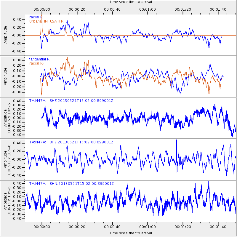
N47A Urbana, IN, USA - Earthquake Result Viewer
*The percent match for this event was below the threshold and hence no stack was calculated.
| Earthquake location: |
Off East Coast Of Kamchatka |
| Earthquake latitude/longitude: |
52.6/160.6 |
| Earthquake time(UTC): |
2013/05/21 (141) 14:51:19 GMT |
| Earthquake Depth: |
37 km |
| Earthquake Magnitude: |
5.6 MW, 5.5 MW |
| Earthquake Catalog/Contributor: |
NEIC PDE/NEIC PDE-W |
|
| Network: |
TA USArray Transportable Network (new EarthScope stations) |
| Station: |
N47A Urbana, IN, USA |
| Lat/Lon: |
40.88 N/85.69 W |
| Elevation: |
252 m |
|
| Distance: |
70.7 deg |
| Az: |
47.384 deg |
| Baz: |
323.692 deg |
| Ray Param: |
$rayparam |
*The percent match for this event was below the threshold and hence was not used in the summary stack. |
|
| Radial Match: |
40.15617 % |
| Radial Bump: |
400 |
| Transverse Match: |
47.86091 % |
| Transverse Bump: |
400 |
| SOD ConfigId: |
512894 |
| Insert Time: |
2013-09-14 14:48:58.340 +0000 |
| GWidth: |
2.5 |
| Max Bumps: |
400 |
| Tol: |
0.001 |
|
Signal To Noise
| Channel | StoN | STA | LTA |
| TA:N47A: :BHZ:20130521T15:02:00.899001Z | 0.46404523 | 5.5935825E-8 | 1.205396E-7 |
| TA:N47A: :BHN:20130521T15:02:00.899001Z | 1.4548051 | 1.9739109E-7 | 1.3568216E-7 |
| TA:N47A: :BHE:20130521T15:02:00.899001Z | 0.41208553 | 4.4100187E-8 | 1.07017065E-7 |
| Arrivals |
| Ps | |
| PpPs | |
| PsPs/PpSs | |


