You are here: Home > Network List > TA - USArray Transportable Network (new EarthScope stations) Stations List
> Station E45A Wooded Hills, Hulbert, MI, USA > Earthquake Result Viewer
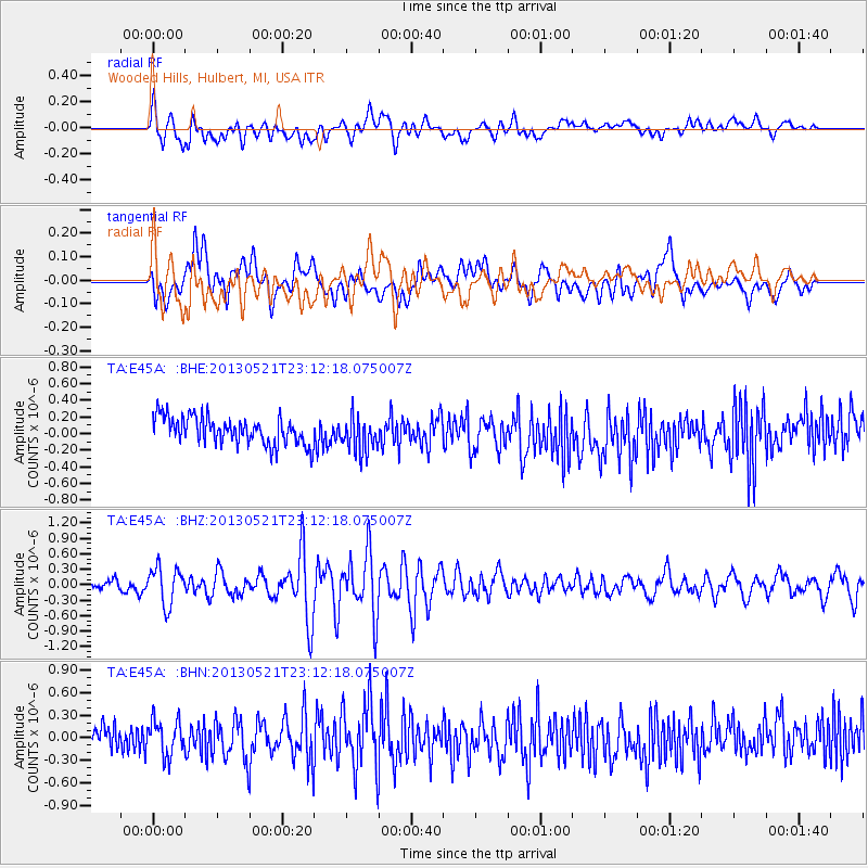
E45A Wooded Hills, Hulbert, MI, USA - Earthquake Result Viewer
*The percent match for this event was below the threshold and hence no stack was calculated.
| Earthquake location: |
Central Peru |
| Earthquake latitude/longitude: |
-13.8/-72.3 |
| Earthquake time(UTC): |
2013/05/21 (141) 23:02:45 GMT |
| Earthquake Depth: |
92 km |
| Earthquake Magnitude: |
5.8 MW, 5.7 MB, 5.8 MW |
| Earthquake Catalog/Contributor: |
NEIC PDE/NEIC PDE-W |
|
| Network: |
TA USArray Transportable Network (new EarthScope stations) |
| Station: |
E45A Wooded Hills, Hulbert, MI, USA |
| Lat/Lon: |
46.36 N/85.18 W |
| Elevation: |
251 m |
|
| Distance: |
61.0 deg |
| Az: |
349.804 deg |
| Baz: |
165.623 deg |
| Ray Param: |
$rayparam |
*The percent match for this event was below the threshold and hence was not used in the summary stack. |
|
| Radial Match: |
65.15475 % |
| Radial Bump: |
400 |
| Transverse Match: |
47.863758 % |
| Transverse Bump: |
400 |
| SOD ConfigId: |
512894 |
| Insert Time: |
2013-09-14 15:22:07.022 +0000 |
| GWidth: |
2.5 |
| Max Bumps: |
400 |
| Tol: |
0.001 |
|
Signal To Noise
| Channel | StoN | STA | LTA |
| TA:E45A: :BHZ:20130521T23:12:18.075007Z | 2.6572926 | 3.629359E-7 | 1.3658108E-7 |
| TA:E45A: :BHN:20130521T23:12:18.075007Z | 1.5180676 | 2.396281E-7 | 1.5785075E-7 |
| TA:E45A: :BHE:20130521T23:12:18.075007Z | 1.2834437 | 2.1046003E-7 | 1.6398073E-7 |
| Arrivals |
| Ps | |
| PpPs | |
| PsPs/PpSs | |


